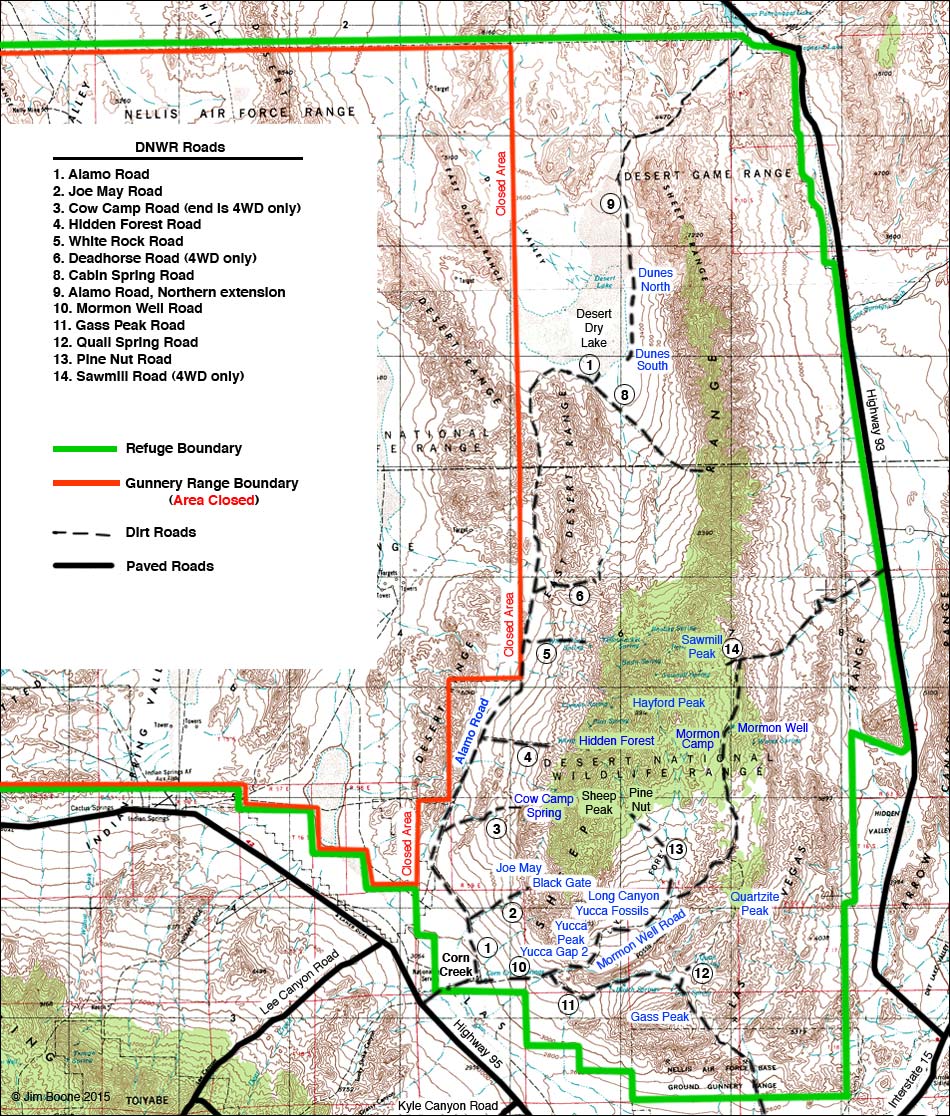
1. Joe May Road; 2. Cow Camp Road; 3. Hidden Forest Road; 4. White Rock Road; 5. Deadhorse Road (4WD only); 6. Sheep Pass; 7. Alamo Road; 8. Cabin Spring Road; 10. Gass Peak Road; 11. Pine Nut Road; 12. Desert Campground; 13. Sawmill Road (4WD only)
Note: Roads are black (solid = paved; dashed = unpaved). Trails and routes are red (solid = main; dashed = adjacent or alternate). Boundaries are green (wildlife refuge) and orange (bombing area). Map based on USGS 7.5 minute topo map. North is at the top. Only public roads on the Desert National Wildlife Refuge are shown; service roads are closed to private vehicles and are not shown.
The western portion of this map is on the Wildlife Refuge (green), but it is also part of the Air Force Bombing Range (orange) and is closed to the public. The entire Desert National Wildlife Refuge is much larger than shown here.
Happy hiking! All distances, elevations, and other facts are approximate.
![]() ; Last updated 240713
; Last updated 240713
| DNWR Overview | Hiking Around Las Vegas | Glossary | Copyright, Conditions, Disclaimer | Home |