Birding Around Las Vegas, Outside the Las Vegas Valley, Pahranagat Valley
 Highway 93 at turnoff to the trailhead (view N) |
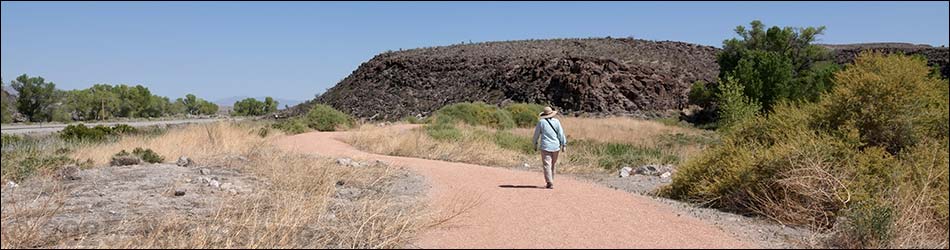
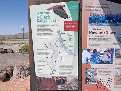
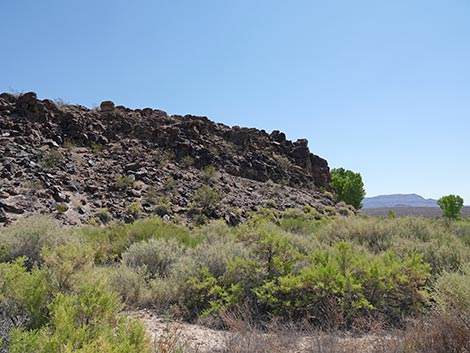
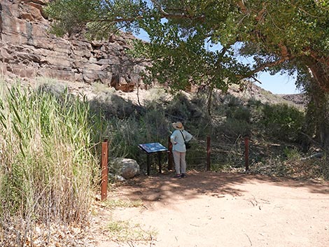
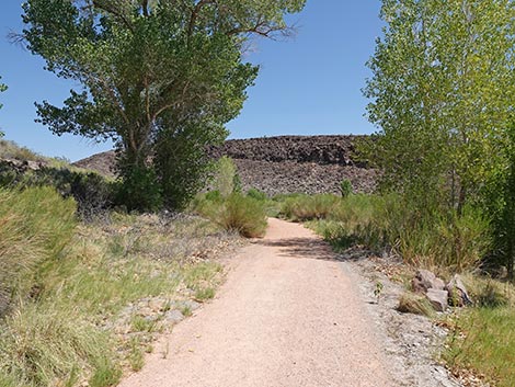
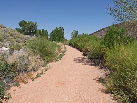
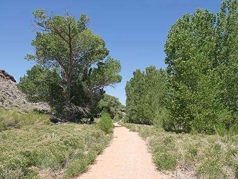
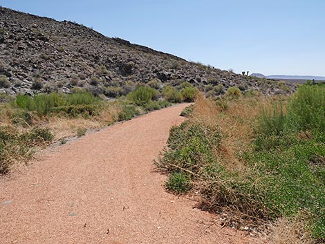
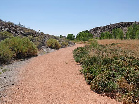
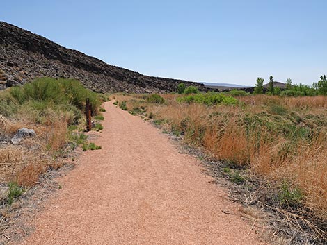
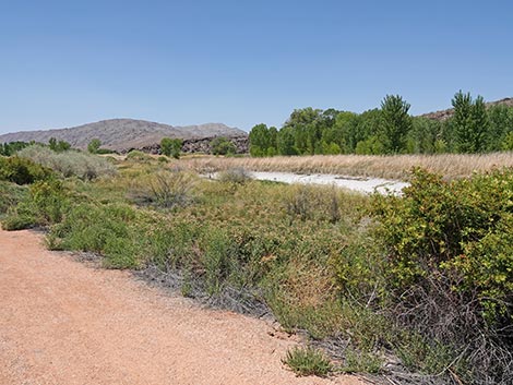
Description Pahranagat (paw-RAN-a-cat) National Wildlife Refuge protects 5,380 acres of shallow lakes, brushy thickets, marshes, grassy meadows, and cottonwood trees, all of which supports a great variety of birds and other wildlife. Black Canyon Trail provides access to some of this habitat. The Black Canyon Trail is an accessible trail with a hard, graveled surface that makes a loop. A spur trail runs out to a petroglyph viewing site with nice examples of the Pahranagat Man motif. After returning to the main trail, hikers continue a short distance to a fork in the trail. Hikers can stay right on a Cutoff Trail to make a short loop (0.70) back to the trailhead or stay left and make a longer loop (1.44) that passes another petroglyph viewing site. Note that the longer loop is closed during bird nesting season. In addition to the petroglyphs, hikers should watch for birds in the trees, the shrubs along the trail, the muddy shallows at the edge of three little lakes, and the open water of the ponds. Link to map. |
 Highway 93 turning into trailhead parking area (view NE) |
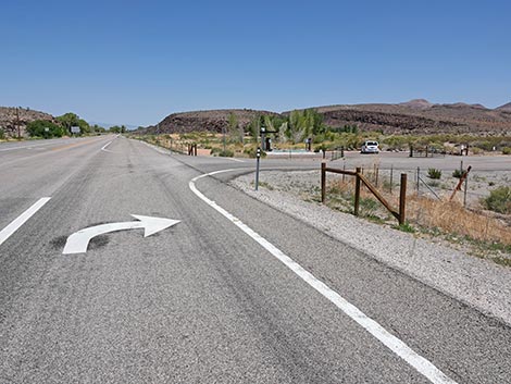
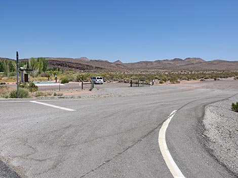
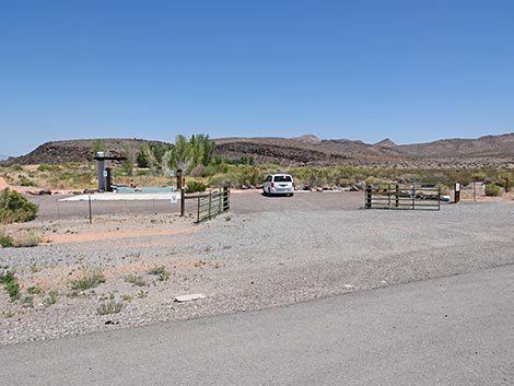
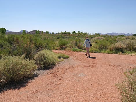
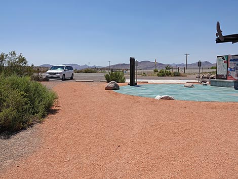
Watch Out Other than the standard warnings about hiking in the desert, ...this hike is pretty safe when the weather is cool. If the weather is hot, this area can be surprisingly hot. Also, the fact that the trail is almost entirely smooth and level creates a potential tripping hazard because you forget to watch where your feet are stepping, and Pocket Gophers sometimes dig holes in the trail. While hiking, please respect the land and the other people out there, and please try to Leave No Trace of your passage. This walk is short, so just bring what you need of the 10 Essentials. Getting to the Trailhead Pahranagat NWR is located about 90 miles northeast of Las Vegas on Highway 93 in Lincoln County. From town, drive north on Interstate 15 and Highway 93 to the Pahranagat Visitor Center. Watch for the big signs. At the Visitor Center turnoff, turn right -- away from the Visitor Center -- into the trailhead parking area, which is clearly visible from the highway. Park here; this is the trailhead. |
 Trailhead parking inside the gate (view NE) |
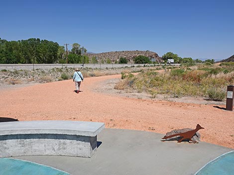
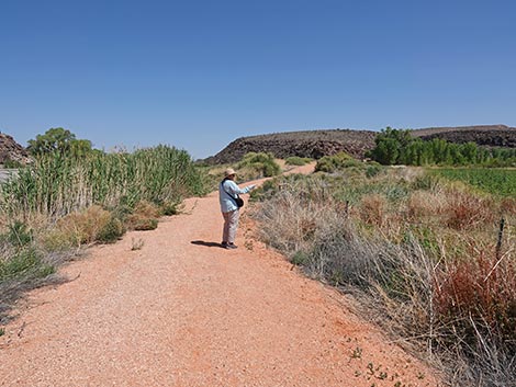
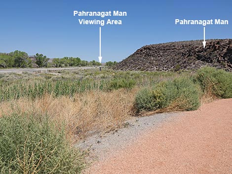
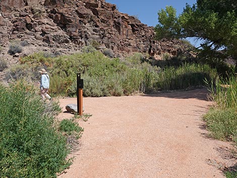
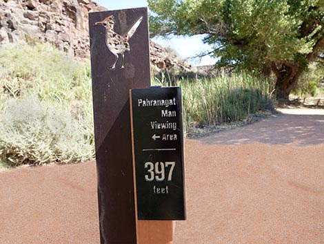
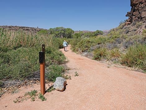
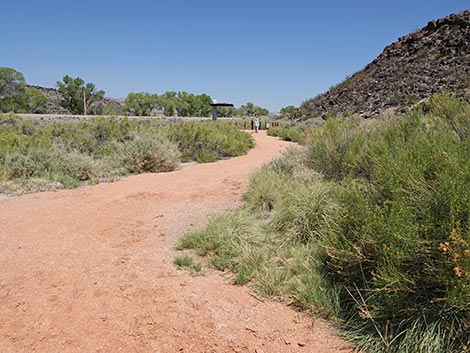
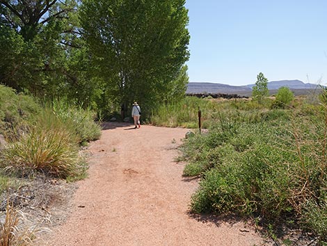
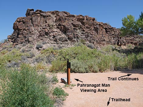
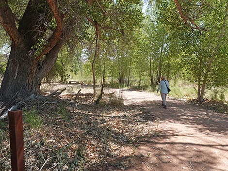
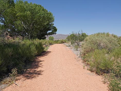
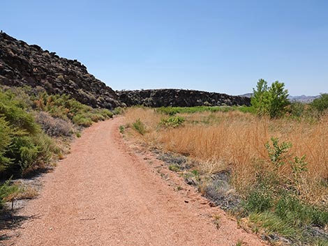
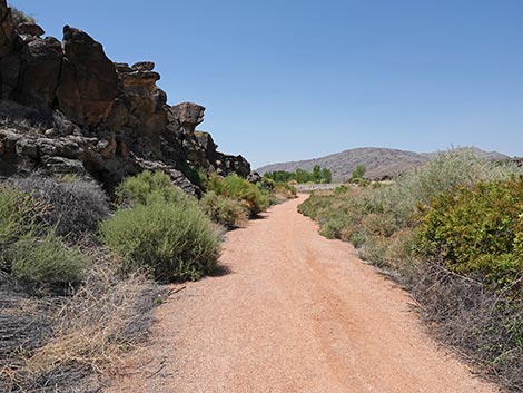
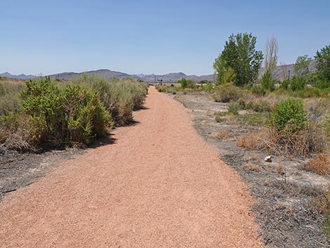
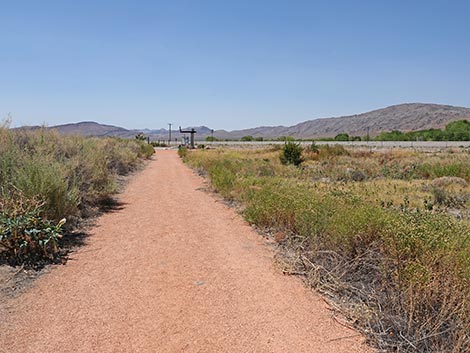
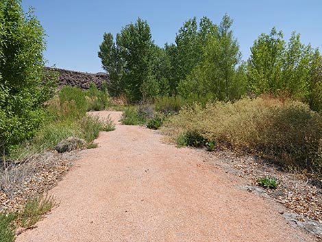
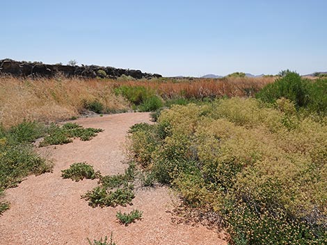
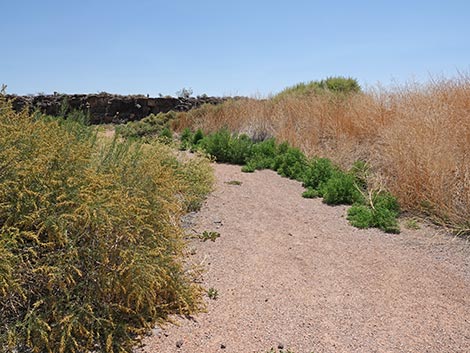
The Hike From the trailhead (Table 1, Waypoint 01), two trails run northward: one to the left and another to the right. Because the trail is a loop, hikers can start on either trail. As described here, however, the outbound trail leaves to the left while the return trail comes back on the right. Starting to the left, the trail runs out towards the highway, then parallels the highway fence heading north. At about 140 yards out, the trail bends away from the highway, and although it is still close, the trail begins to feel more wild, and it provides some nice views across the marsh. At about 0.21 miles out, the hikers arrive at a trail junction (Wpt. 02), which sits at the base of a rocky hillside. At this trail junction, the main trail stays to the right, but the spur trail to the Pahranagat Man Viewing Area turns left. |
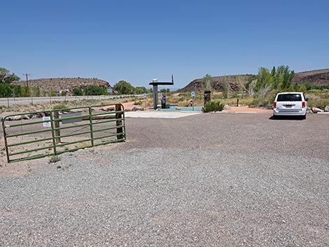 Entering the gated trailhead area (view N) |
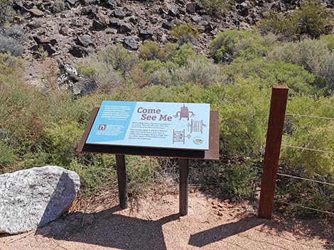
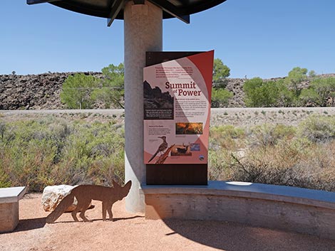
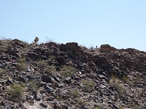
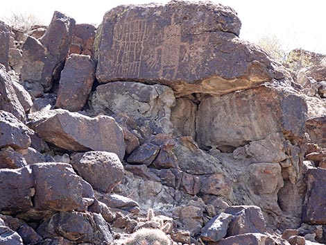
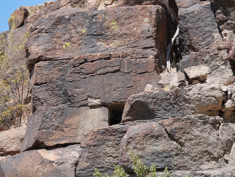
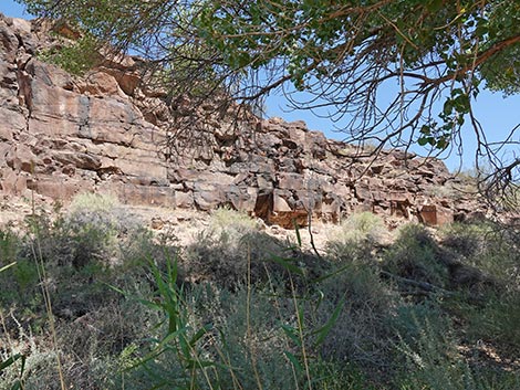
Staying left onto the spur trail, the trail runs west towards the highway, then bends to the northwest and ends at the Pahranagat Man Viewing Area (Wpt. 03). Here, at the end of the trail, there is a shade structure, benches, information signs, and two telescopes that aid in seeing petroglyphs near the top of the rocky crags to the east. The sign Summit of Power provides native American perspectives on the land and the petroglyphs. The other sign, Come See Me, provides words about the important messages written on these rocks, but it takes a good heart to understand them. There seem to be two basic ways that ancient people depicted what we call Pahranagat Man: one with a big body, a dome-shaped head with eyes and a top-knot, and arms with exaggerated fingers, and the other looking more like a fringed blanket draped on the rock wall. This site is interesting because on one rock face, hikers can see both forms side-by-side. There are other petroglyphs up there too; look around and see what you can find, but hiking off-trail is prohibited here. From the Pahranagat Man Viewing Area (Wpt. 03), hikers return over the spur trail to the main Black Canyon Trail (Wpt. 02). |
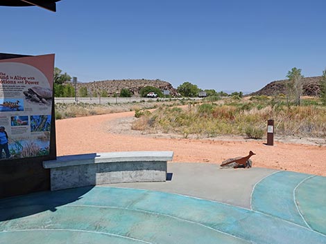
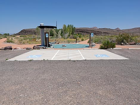 Trailhead with accessible parking (view N) |
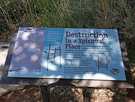
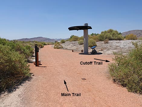
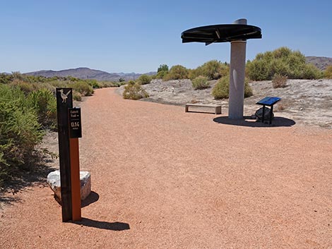
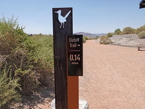
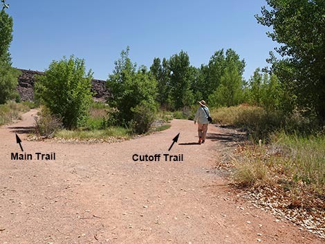
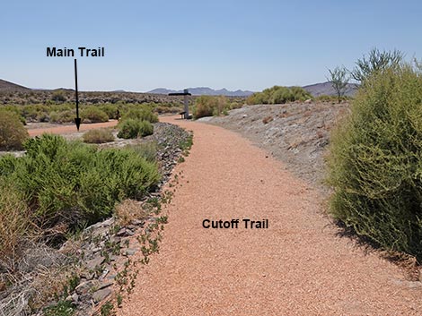
With one's eyes now trained to see petroglyphs, hikers should take a moment at this trail junction to look up at the rocky crags. There are a number of petroglyphs here, including some nice examples of the blanket-type Pahranagat Man petroglyph. Continuing northeast on the main Black Canyon Trail, hikers pass into the shade of Cottonwood Trees and arrive at a information sign on the left. This sign, Destruction in a Spiritual Place, describes damage to petroglyphs caused by a shotgun blast and how that weighs heavily on the hearts of the artist's descendants. Continuing only a few more yards on the Black Canyon Trail, the trail forks at another junction (0.37 miles out; Wpt. 04) marked with a trail sign. Here, the main trail stays left while the Cutoff Trail forks right. For hikers without the time or inclination to walk the entire 1.44-mile loop, they can stay right on the Cutoff Trail and loop back to the trailhead for a total of only 0.70 miles. The Cutoff Trail runs southeast (0.14 miles) to reconnect with the main Black Canyon Trail below the rocky crags visible across the canyon. |
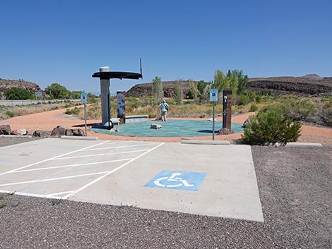 Accessible trailhead parking (view N) |
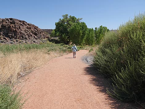
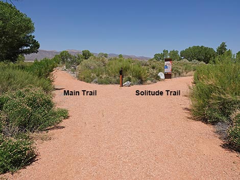
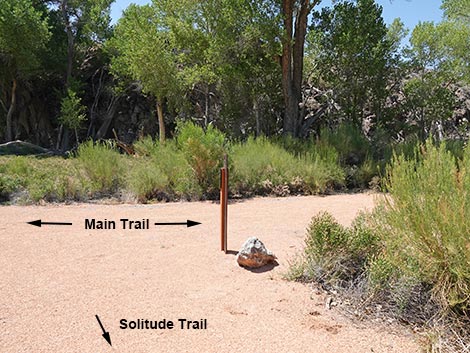
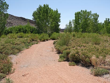
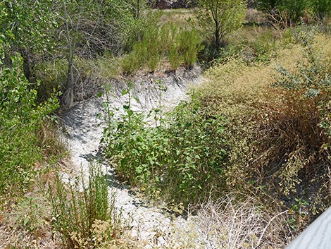
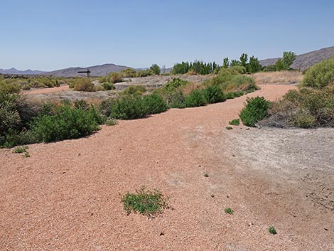
Staying to the left, the main Black Canyon Trail begins to curve left wrapping around the toe of the rocky crag with the petroglyphs. At about its east-most extent, the trail passes Middle Lake on the right. This lake goes dry during summer, but during other times of year, this is a good place to look for wild ducks on the pond and other birds in the marsh vegetation. The trail continues wrapping around the side of the rocky ridge and passes more large cottonwood trees before encountering another trail-side information sign, this one without a shade structure. The sign here describes a Place of Plenty, with text about how water provides life for trees and other vegetation, which in turn provide life for birds and other creatures who migrate here from the tropics every spring. Just passed the sign, the trail forks again (Wpt. 05). Here, the main Black Canyon Trail stays left to head westerly while the Solitude Trail forks to the right heading more to the north. |
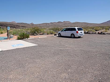 General trailhead parking (view NE) |
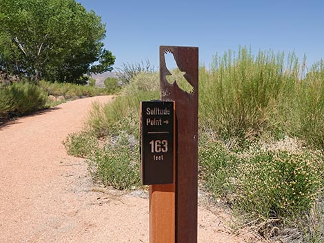
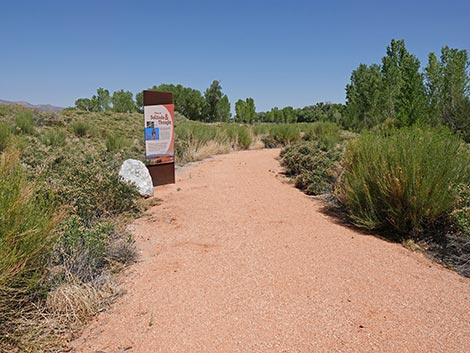
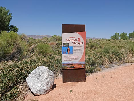
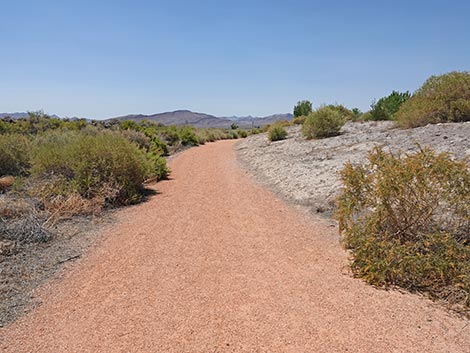
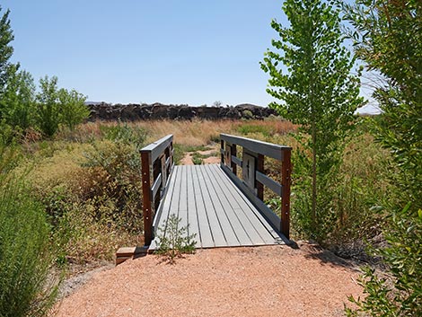
The short Solitude Trail runs north for about 100 feet, bends right for another 70 feet, and ends (Wpt. 06) at the edge of the stream surrounded by young Cottonwood Trees and other marsh vegetation. Benches provide a place to sit and enjoy the feeling of solitude. When refreshed, hikers can return to the Black Canyon Trail (Wpt. 05). Continuing west on the Black Canyon Trail, the trail bends right and heads more northward again. As the trail continues bending to the right, then heading due east, the trail arrives at a bridge over the stream. While crossing the stream, which is dry during summer, notice the artwork on the railings and on the vertical insides of the bridge. The Woodhouse’s Toad sculpture is quite realistic, and the bird silhouette cut-outs are very artistic. One seems to be a Prairie Falcon, the other other looks like a Black Phoebe. Beyond the bridge, the trail bends right and begins returning to the trailhead. The trail runs along the base of rocky crags on the left with the marsh on the right. The rocky hillside supports Mojave Desert vegetation such as Eastern Joshua Trees and Cottontop Cactus (which look like clumps of California Barrel Cactus) and other desert species. The marsh supports species such as Southern Cattail, Baccharis shrubs, and Greasewood. Upper Pond is hidden in the marsh here too. |
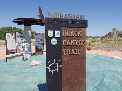 Black Canyon Trailhead sign (view NW) |
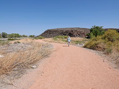
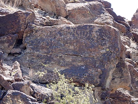
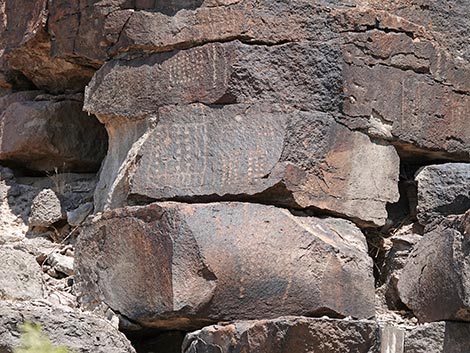
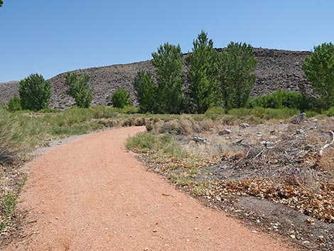
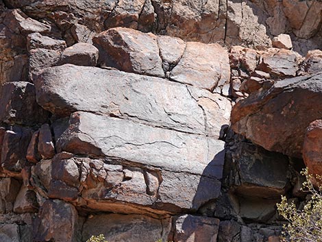
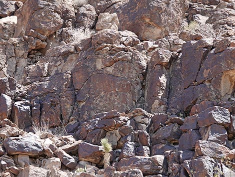
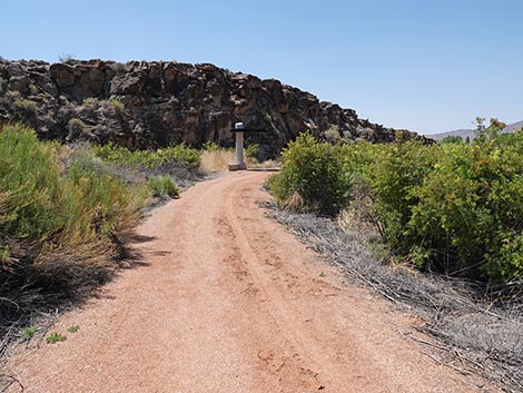
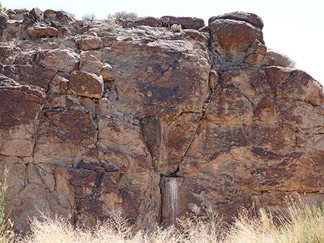
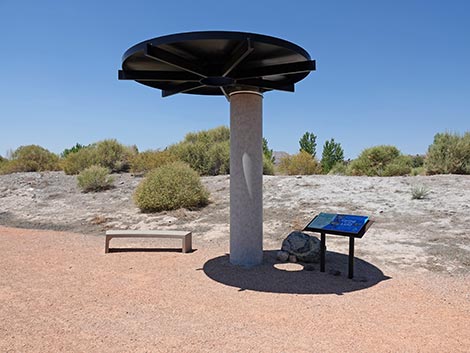
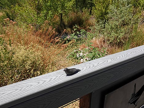
At about 1.81 miles out, the trail reaches another petroglyph viewing station (Wpt. 08). As at the previous one, there is a shade structure with benches, two signs, and two telescopes. The petroglyphs here that match the images on one sign are located near the top of the cliffs to the left. There are two Pahranagat Man figures on one rock face, one of regular style and one of the blanket-type style. The first sign, The Power of Rock Writing, provides some information about how local Native Americans interpret petroglyphs today. The other sign, A Feast for the Senses, provides words about sitting quietly and experiencing the sights, sounds, and smells of the place. It is probably not a good idea to taste things here, and don't ever touch petroglyphs. The trail continues along the base of the rock wall as it curves from the southeast to the southwest. The trail passes a short box canyon that cuts into the side of the cliff. On the rock wall at the back, hikers will notice whitewash (a polite word for heavy streaks of bird poop) below a small niche: evidence that some species of large bird spends a fair bit of time sitting there. When I was here, I saw a Red-tailed Hawk and a Great Horned Owl. Either of these birds could be the culprit leaving the whitewash behind, or it could be Common Ravens. |
 Black Canyon Trailhead information signs (view NW) |
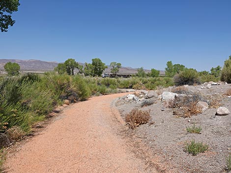
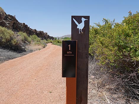
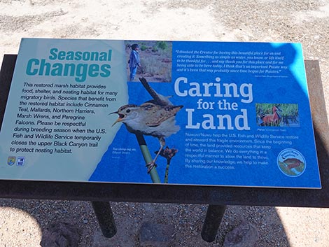
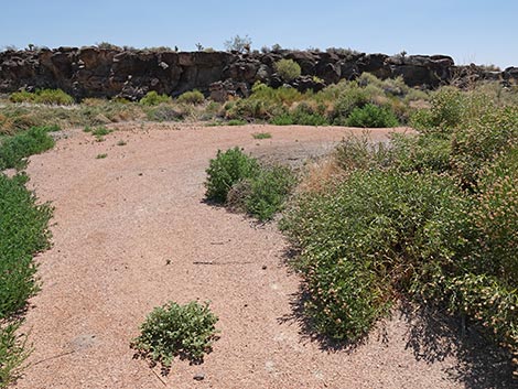
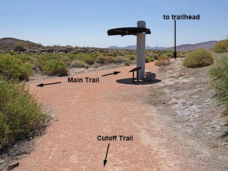
Just past the box canyon, hikers encounter another shade structure and a bench, but no sign. Shortly beyond there, the trail passes a trail sign announcing the 1-mile mark. To the right, hikers will notice Lower Pond, which is dry during the summer. The trail continues southwest along the base of the rocky cliffs, which now are fairly low. At about 1.03 miles out, the trail bends to the right to run more due south. At that point, hikers might notice a side trail coming in from the right. This is the other end of the Cutoff Trail. Just ahead, the Black Canyon Trail reaches the trail junction (Wpt. 09) with the Cutoff Trail, which is marked by a shade structure, a bench, and a sign. The sign, Seasonal Changes and Caring for the Land, provides information about seasonal trail closures to protect nesting birds and about people working together to protect this landscape. From the trail junction (Wpt. 09), the Black Canyon Trail continues fairly straight south-southwest. Initially, there is a bit of a berm on the right side of the trail that limits views over the marsh, but this doesn't last very long. Towards the end of the trail, hikers get another nice view of the marsh before arriving back at the trailhead (Wpt. 01). |
Black Canyon Trailhead
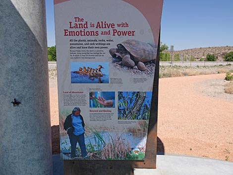
 Black Canyon Trailhead left information sign (view W) |
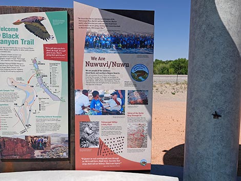 Black Canyon Trailhead middle information sign (view W) |
 Black Canyon Trailhead right information sign (view W) |
 As described here, this is the outbound trail (view NE) |
 As described here, this is the return trail (view NE) |
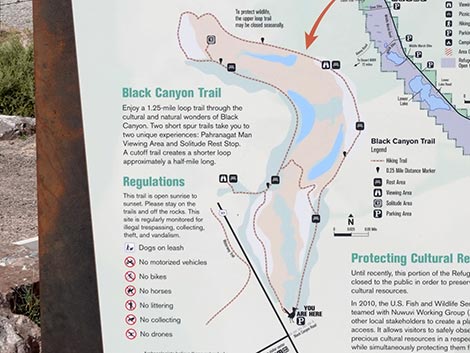 Trail map with some regulations |
Black Canyon Trail
 Hiker departing the trailhead (view NW) |
 The trail angles left, then bend right (view NW) |
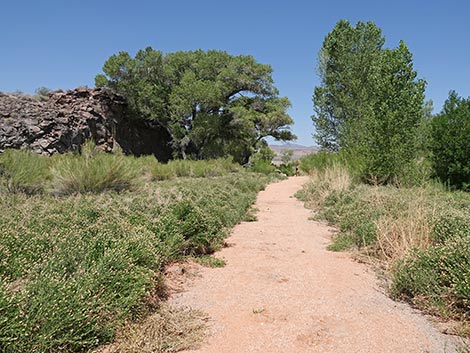
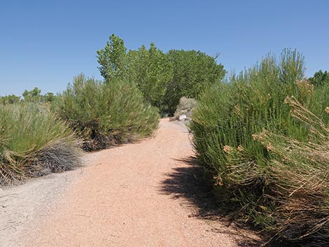
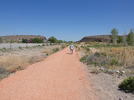 Initially, the trail closely parallels the highway (view N) |
 Lots of marsh vegetation along the trail (view N) |
 The trail bends back towards the highway (view N) |
 The first petroglyph viewing site comes into view (view N) |
 The trail bends back away from the highway (view NE) |
 Hiker approaching the first trail junction (view NE) |
Spur Trail to First Petroglyph Viewing Site (Pahranagat Man Viewing Area)
 Hiker turning left onto spur trail to First Petroglyph Viewing Site |
 Trail sign at the junction (view NE) |
 Hiker continuing past the trail junction (view W) |
 Trail runs between thickets of marsh vegetation (view W) |
 Approaching what appears to be a trail junction (view NW) |
 Trail bends right to again run parallel to the highway (view N) |
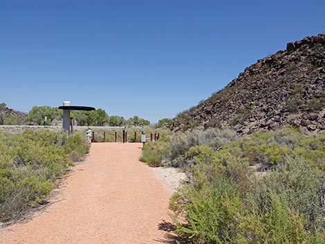 Approaching the Pahranagat Man Viewing Area (view N) |
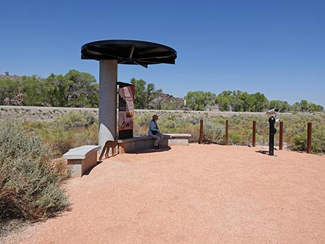 Shade structure and benches at end of spur trail (view NW) |
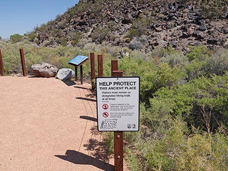 Sign: stay on the trail (view N) |
 Information sign (view NE) |
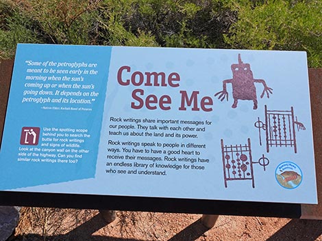 Sign: "Come See Me" says the three Pahranagat men (view NE) |
 Sign and artwork under the shade structure (view W) |
 Sign: Summit of Power (view W) |
 Petroglyphs are located on the crest of the rocky ridge (view SE) |
 Crest of the rocky ridge (view SE) |
 Petroglyphs on the crest of the rocky ridge (view SE) |
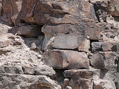
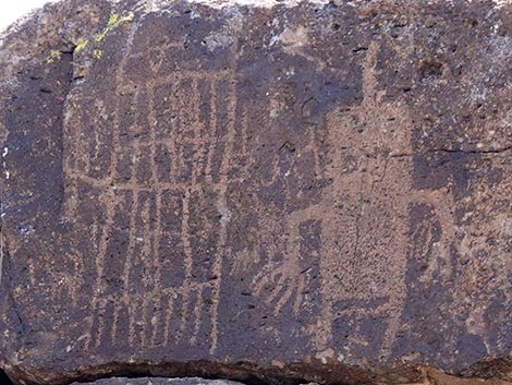 Two versions of Pahranagat Man |
 Petroglyphs on the crest of the rocky ridge (view SE) |
 Petroglyphs on the crest of the rocky ridge (view SE) |
 Looking for more petroglyphs while departing the viewing area |
 Hiker departing the Pahranagat Man Viewing Area |
 Hiker returning to the main trail (view E) |
Main Loop Trail Continues
 Hiker back at the trail junction |
 Stopping for a moment at the junction to look at the rocks (view N) |
 Rocky hillside (view N) |
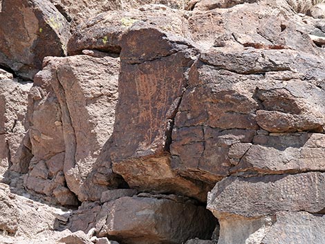
 Yes, there are petroglyphs here too (view N) |
 Petroglyphs; more Pahranagat men (view N) |
 Petroglyphs (view N) |
 Petroglyphs (view N) |
 Continuing on the main trail (view NE) |
 On the left, another information sign (view NE) |
 Sign: Destruction of a Spiritual Place |
 Looking left from the sign (view NW) |
 Petroglyphs on the rocks seen from the trail junction (view NW) |
 Looking right from the sign (view NE) |
 Petroglyphs (view NE) |
 Hiker continuing on the main trail (view NE) |
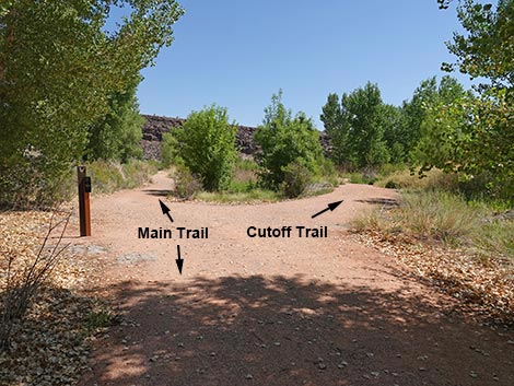 The trail forks: Main Trail left; Cutoff Trail right (view NE) |
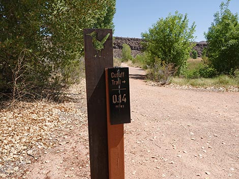 Trail junction sign; Cutoff Trail is 0.14(view NE) |
 Staying left on the main trail (view NE) |
 Continuing on the main trail (view NE) |
 Continuing on the main trail (view NE) |
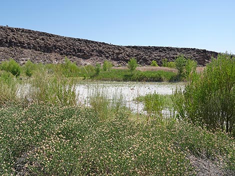 Middle Lake dries down during summer (view E) |
 Continuing on the main trail (view N) |
 Lots of big cottonwood trees along the trail (view NW) |
 There's a Great Horned Owl in the trees on the left (view NW) |
 Approaching another information sign and bench (view NW) |
 Sign and bench (view W) |
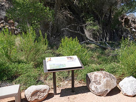 Information sign (view W) |
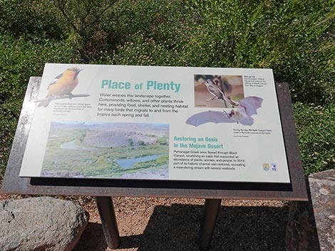 Sign: Place of Plenty (view W) |
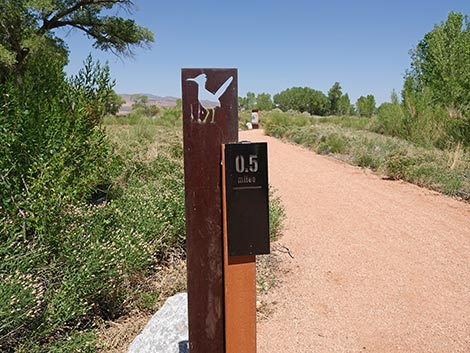 Trail marker, about 1/2 miles out, not counting P-Man spur trail |
 Black Canyon Trail approaching another trail junction (view NW) |
Solitude Spur Trail: A place of solitude and thought
Solitude Trail forks right from Black Canyon Trail (view NW) |
 Trail marker (view NW) |
 Beginning of Solitude Trail (view N) |
 Approaching an information sign (view N) |
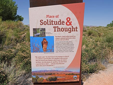 Sign: Place of Solitude and Thought (view N) |
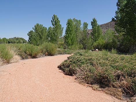 Solitude Trail bends right (view N) |
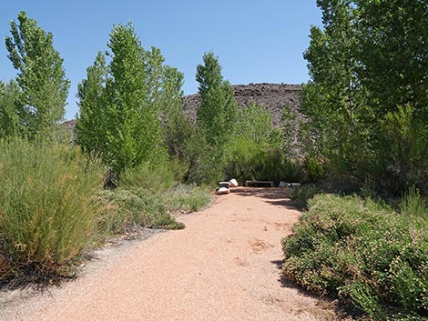 Approaching end of Solitude Trail (view NE) |
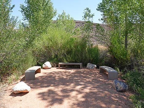 End of Solitude Trail (view NE) |
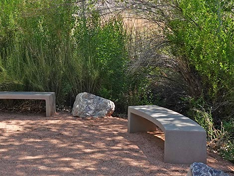 Relax and enjoy the quiet and solitude at the edge of the stream |
 End of Solitude Trail, starting back to main trail (view SE) |
 Returning to the "Place of Solitude and Thought" sign (view S) |
 Solitude Trail returning to the main trail (view SE) |
Main Loop Trail Continues
 Continuing on the Black Canyon Trail (view NW) |
 Black Canyon Trail gets close to Highway 93 again (view NW) |
 Black Canyon Trail bends right (view N) |
 Black Canyon Trail begins looping back towards trailhead (view NE) |
 Trail crosses bottom of the valley (view SE) |
 Trail keeps looping back towards the trailhead (view SE) |
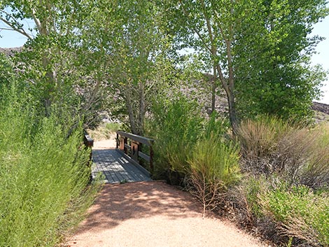 Black Canyon Trail approaching bridge over the stream (view E) |
 Bridge over the stream (view NE) |
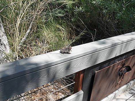 A toad on the bridge? |
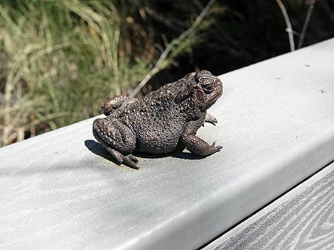 Toad art: metal Woodhouse's Toad |
 The stream is dry (view upstream) |
 The stream is dry (view downstream) |
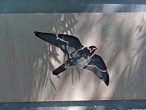 More art on the bridge: Prairie Falcon |
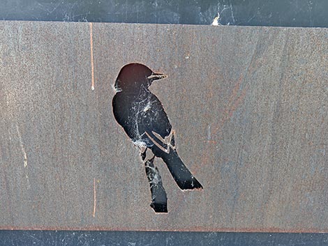 Art on the bridge: Black Phoebe, a flycatcher |
 The trail completes the loop at the top of the canyon (view SE) |
 The Black Canyon Trail begins back towards the trailhead (view SE) |
 The Black Canyon Trail approaching a trail marker (view SE) |
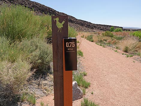 Trail marker, about 3/4 miles out (view SE) |
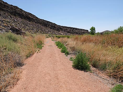 Very little shade on this side of the canyon (view SE) |
 Nice, rocky cliffs at the top of the ridge (view SE) |
 Approaching the second petroglyph viewing site (view SE) |
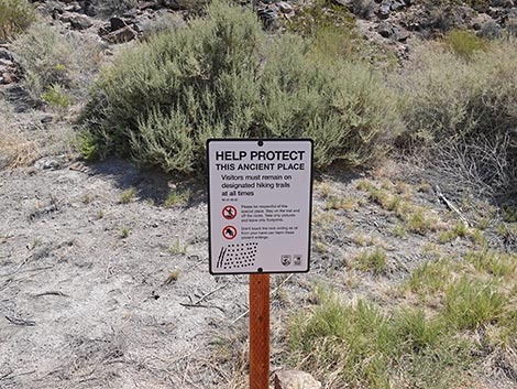 Remember, stay on the trail (view NE) |
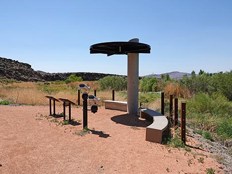 Shade, benches, and more information signs (view SE) |
 Telescopes for viewing the petroglyphs (view N) |
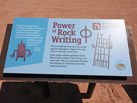 Sign: Power of Rock Writing (view N) |
 Petroglyphs in the glare (view W) |
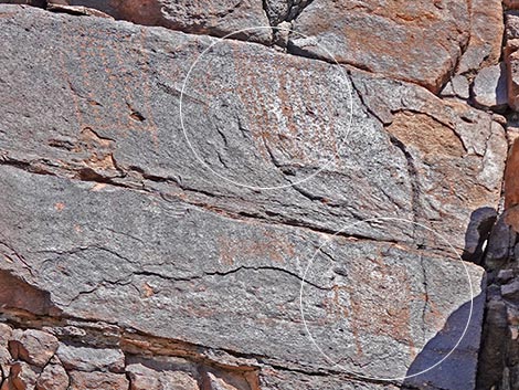 Two forms of Pahranagat Man (view N) |
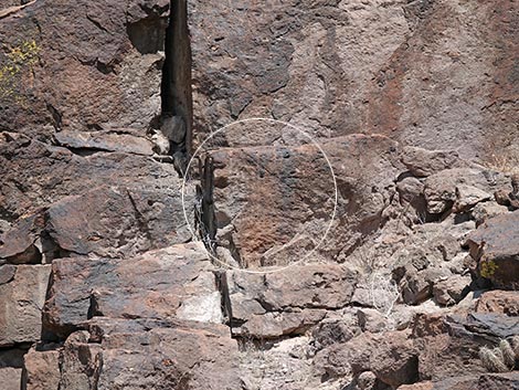
 Maybe more petroglyphs? (view N) |
 Maybe more petroglyphs? (view N) |
 Sign: A feast for the Senses (view NE) |
 Continuing past the second petroglyph viewing site (view SE) |
 No natural shade on this side of the canyon (view SE) |
 Approaching a shade structure (view S) |
 A white-washed niche in the cliff - a big birds spends time there |
 Shade structure and a bench (view S) |
 Black Canyon Trail continues past the shade structure (view SW) |
 Trail marker: about 1 mile out (view SW) |
 Lower Lake is dry during summer (view W) |
 Black Canyon Trail continues along the cliffs (view SW) |
 Black Canyon Trail (view SW) |
 Black Canyon Trail approaching Cutoff Trail junction (view SW) |
 Black Canyon Trail at trail junction and shade structure (view SW) |
 Trail marker (view SW) |
 Trail marker: Cutoff Trail to the right (view SW) |
 Shade, bench, and information sign (view W) |
 Sign: Caring for the Land (view W) |
 Black Canyon Trail continues past the trail junction (view SW) |
 No natural shade on this side of the canyon (view SE) |
 Black Canyon Trail approaching the trailhead (view SW) |
 Black Canyon Trail arriving at the trailhead (view SW) |
 Trail marker: 1-1/4 miles out (view S) |
 Black Canyon Trail returning to the trailhead (view S) |
Cutoff Trail. The Cutoff Trail makes for a shorter loop.
 Hiker departing the main trail (view NE) |
 Cutoff trail starts across the canyon (view NE) |
 Cutoff trail bends right (view E) |
 Cutoff trail approaching a bridge (view NE) |
 Cutoff trail approaching a bridge (view SE) |
 The stream is dry (view upstream) |
 Art on the bridge: a dragonfly |
 The stream is dry (view downstream) |
 More art on the bridge: perhaps a marsh wren |
 Trail bends right beginning to switchback up a low hillside (view S) |
 The trail is getting overgrown (view SW) |
 Trail bends back to the left (view S) |
 Trail switchbacks to the right (view E) |
 Trail bends back to the right (view S) |
 Trail junction and shade comes into view (view S) |
 Arriving at trail junction and shade structure (view S) |
Table 1. GPS Coordinates for Highway Locations (NAD27; UTM Zone 11S). Download Hiking GPS Waypoints (*.gpx) file.
| Wpt. | Location | UTM Easting | UTM Northing | Elevation (ft) | Point-to-Point Distance (mi) | Cumulative Distance (mi) |
|---|---|---|---|---|---|---|
| 01 | Trailhead | 667150 | 4126771 | 3,396 | 0.00 | 0.00 |
| 02 | Trail Junction | 667084 | 4127070 | 3,372 | 0.21 | 0.21 |
| 03 | Petroglyph View | 666982 | 4127107 | 3,382 | 0.08 | 0.29 |
| 02 | Trail Junction | 667084 | 4127070 | 3,372 | 0.08 | 0.37 |
| 04 | Trail Junction | 667121 | 4127124 | 3,366 | 0.04 | 0.41 |
| 05 | Trail Junction | 666967 | 4127372 | 3,362 | 0.23 | 0.64 |
| 06 | Solitude Benches | 666966 | 4127415 | 3,361 | 0.03 | 0.67 |
| 05 | Trail Junction | 666967 | 4127372 | 3,362 | 0.03 | 0.70 |
| 07 | Bridge | 666943 | 4127475 | 3,360 | 0.13 | 0.83 |
| 08 | Petroglyph View | 667224 | 4127361 | 3,357 | 0.20 | 1.03 |
| 09 | Trail Junction | 667202 | 4127019 | 3,351 | 0.25 | 1.28 |
| 01 | Trailhead | 667150 | 4126771 | 3,396 | 0.16 | 1.44 |
| . | . | . | . | . | . | . |
| 04 | Trail Junction | 667121 | 4127124 | 3,366 | 0.00 | 0.00 |
| 09 | Trail Junction | 667202 | 4127019 | 3,351 | 0.14 | 0.14 |
Happy birding! All distances, elevations, and other facts are approximate.
![]() ; Last updated 250716
; Last updated 250716
| Birding Around Las Vegas | Southern Nevada Birds | Guide Service | Copyright, Conditions, Disclaimer | Home |