Hiking Around Las Vegas, Death Valley National Park
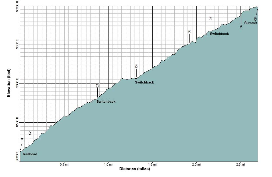
Note: Elevation Profile based on GPS data. Minor blips may be GPS anomalies.
Happy Hiking! All distances, elevations, and other facts are approximate.
![]() ; Last updated 240716
; Last updated 240716
| Rogers Peak Road Route | Hiking Around Death Valley | Glossary | Copyright, Conditions, Disclaimer | Home |