Havasupai Garden to Phantom Ranch
(includes River Trail)
Hiking Around Las Vegas, Grand Canyon National Park
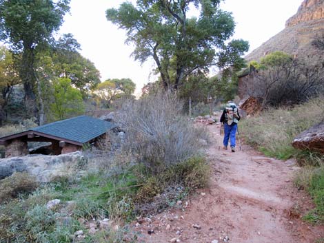
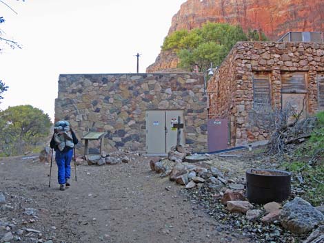
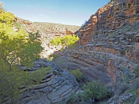
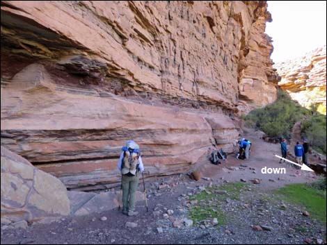
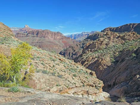
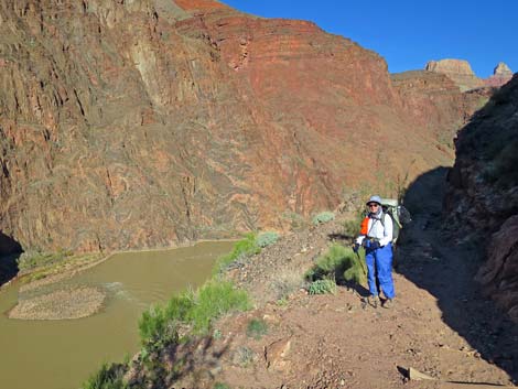
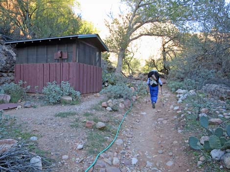
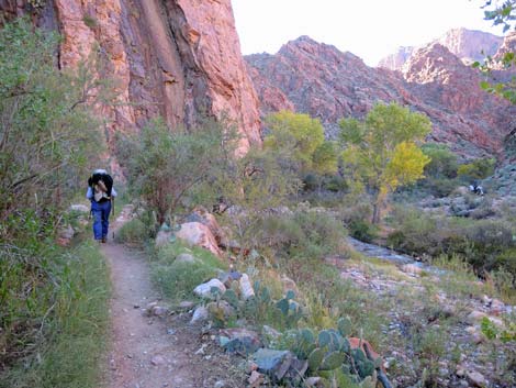
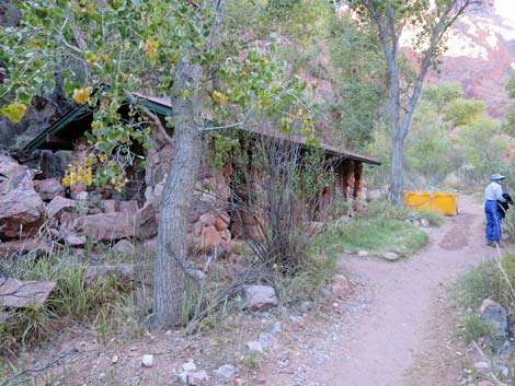
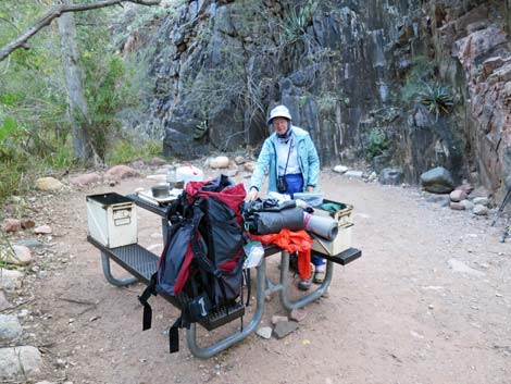
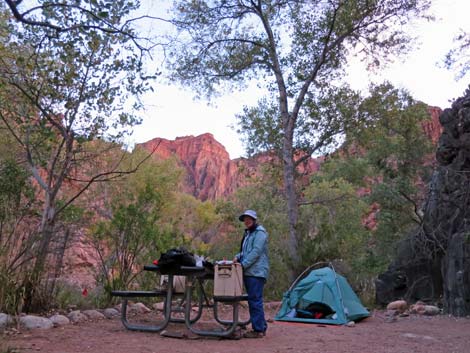
 Packed up and departing Havasupai Garden Campground (view E) |
Overview The Bright Angel (BA) Trail begins near the Bright Angel Lodge on the South Rim and descends some 3,000 feet over 4.6 miles to Havasupai Garden (IG). The trail is open and airy, with many grand views over the cliffs and out into the Grand Canyon. For details of the upper section of the trail, see Upper Bright Angel Trail. From IG, the BA Trail follows Garden Creek until the creek pours over a cliff, then the trail turns and winds down the Devil's Corkscrew through the Vishnu Schist to the bottom of Pipe Canyon. Pipe Creek is followed to the Colorado River, which is then followed upstream to a bridge across the river and to the mouth of Bright Angel Creek. Phantom Ranch and BA Campground are a short way up the creek, about 9.6 miles below the rim via this route. Link to map. |
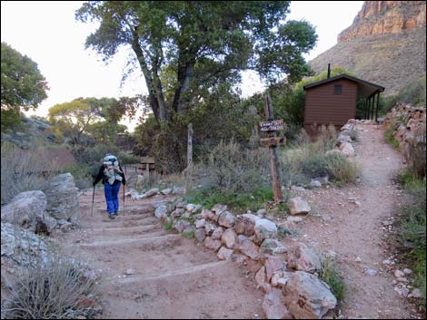
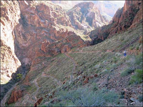
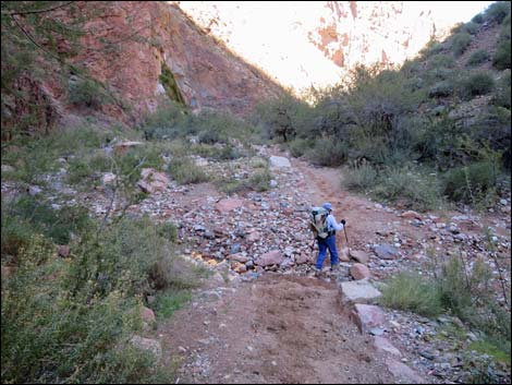
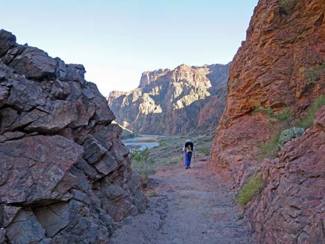
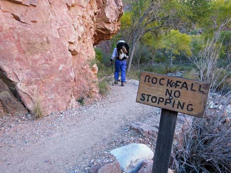
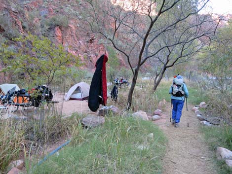
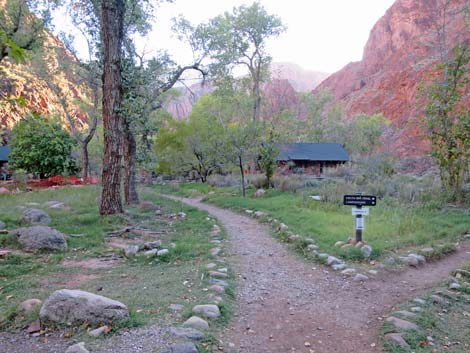
 Exit trail at bottom of campground (view NE) |
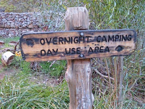
Toilets are available at IG, River Resthouse, and BA Campground, and potable water is available at IG and BA Campground. During the mule-riding season, when droppings on the trail can make for a dusty mess, pay attention to instructions from the wranglers; they probably will tell you to stand quietly on the uphill side of the trail while the mule train passes. Mules have the right-of-way. Watch Out Other than the standard warnings about hiking in the desert, ...this is a wide and pretty safe trail if you stay on it, but there are many places where hikers could stumble off the trail into the abyss. The elevation at the South Rim is surprisingly high, about 7,000 feet, so take it easy if you aren't used to the elevation. Don't be fooled by the cool summer temperatures on the rim; these temperatures quickly give way to scorching summer heat lower in the canyon. Trails here are made by putting down wooden cross-timbers, filling between the cross-timbers with rock rubble, and covering it all with dirt. The trail is easy to walk on when dry; but when wet, each crossbar makes a dam that holds a puddle of mud. |
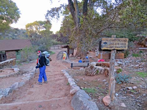
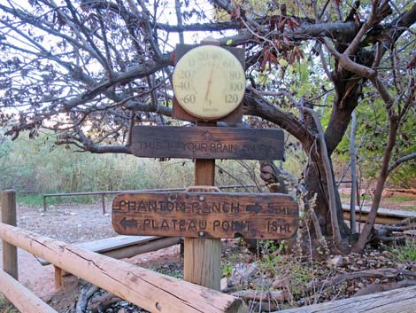
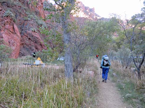
 Sign at edge of campground (view NW) |
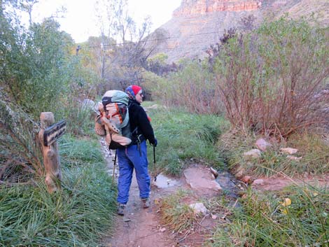
While hiking, please respect the land and the other people out there, and try to Leave No Trace of your passage. This is a fairly long hike, so be sure to bring the 10 Essentials. Be sure that you are physically fit and that you choose routes of the appropriate difficulty for your skills and endurance. Getting to the Trailhead This hike is located on the South Rim of the Grand Canyon, about 5 hours southeast of Las Vegas, and starts near the BA Lodge. For details of getting to the trailhead, see Upper Bright Angel Trail. |
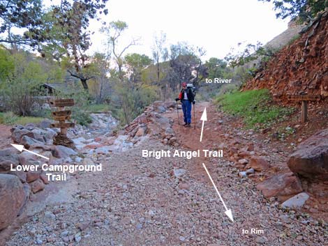
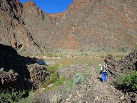
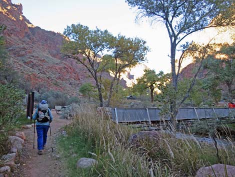
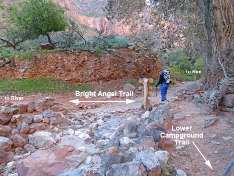 Lower campground trail at Bright Angel Trail (view E) |
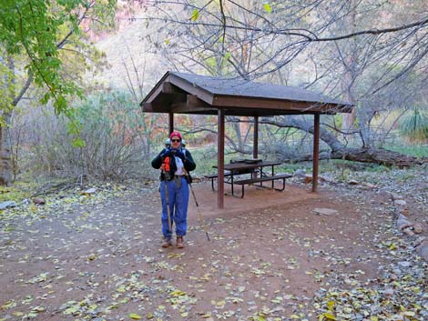
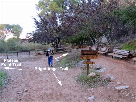
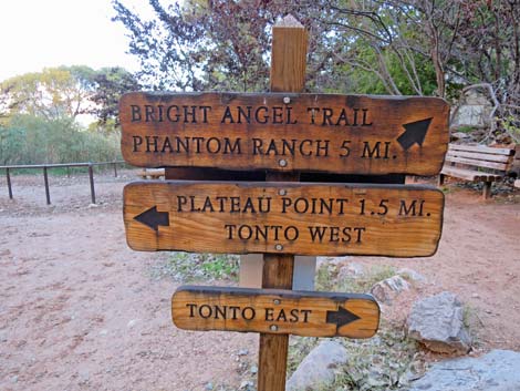
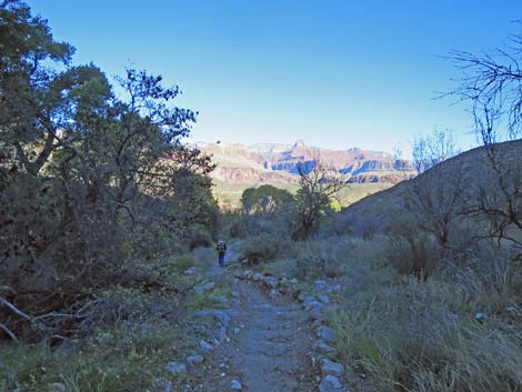
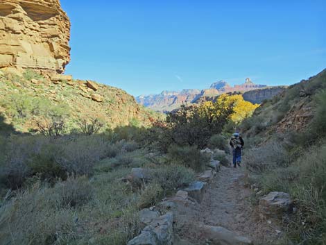
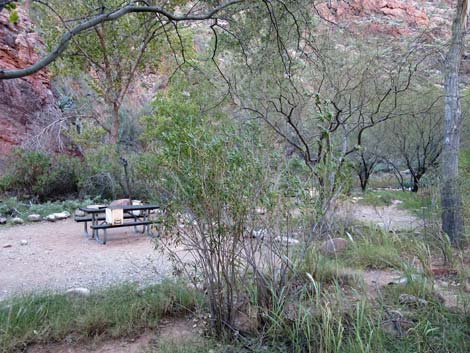
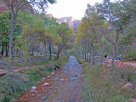
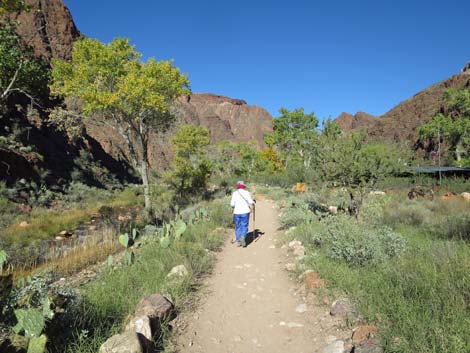
The Hike From the trailhead (Table 1, Wpt. 01), the trail immediately starts down into the canyon at a fair grade and quickly passes the first and second tunnels, 1.5-Mile Resthouse (Wpt. 05), 2-Mile Switchback, and 3-Mile Resthouse (Wpt. 07). The trail then drops over the Redwall, before leveling out somewhat and following Garden Creek to IG Campground (Wpt. 09), which is about 4.6 miles below the rim. For details of this section of the BA Trail, see Upper Bright Angel Trail. From the entrance to IG Campground (Wpt. 09), the trail continues downhill past the campground, picnic shelters, piped water, and composting toilets to the corrals, which also marks the trail junction (Wpt. 10) to Plateau Point. This is a good place to stop and rest in the shade of the tall Cottonwood Trees. Common Ravens and rodents (mostly Rock Squirrels) are a problem here, so be sure to guard your food. |
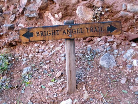 Sign at trail junction (view E) |
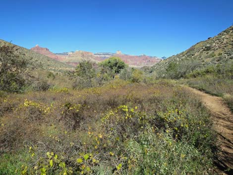
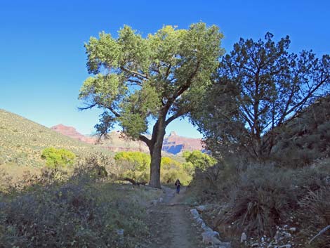
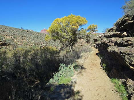
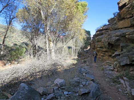
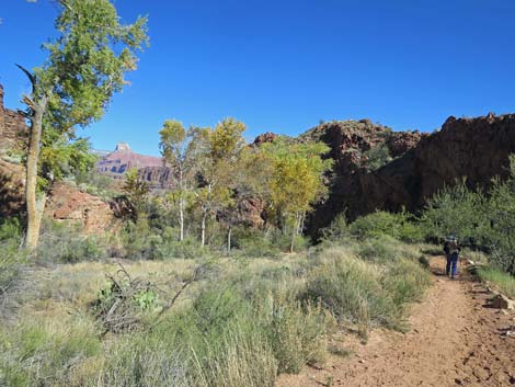
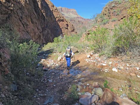
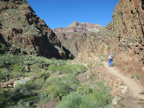
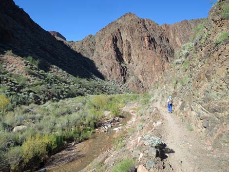
From the Plateau Point Trail junction (Wpt. 10), the BA Trail stays right and passes a stone building (pumphouse for the trans-canyon pipeline) and continues downhill at a moderate grade along the east side of Garden Creek. After about 0.3 miles, the Tonto East Trail (Wpt. 11) forks to the right and runs east out across the hillside. Below the Tonto East Trail junction, the canyon narrows as Garden Creek cuts down into the Tapeats Sandstone. The trail runs on rock ledges above the creek for a while, then drops into the wash and skips back and forth across the creek several times. In this cottonwood-shaded canyon, the trail eventually passes below the Tapeats Sandstone and enters the Vishnu Schist layer (the bottom layer in the Grand Canyon). Where the two meet, at the Great Unconformity, some 1 billion-years-worth of rock are missing from the great book of history. Here, a mountain range formed and eroded away, then the sea came in and laid down beach sand on the billion years schist, and the rest is history. |
 Sign at trail junction (view N) |
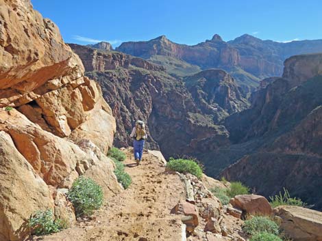
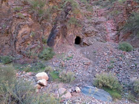
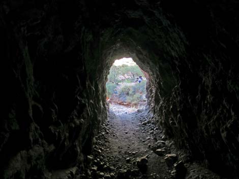
The narrow canyon eventually opens onto the shoulder of a ridge at the top of the Devil's Corkscrew (Wpt. 12). Garden Creek pours off left into a narrow gorge and over cliffs into Pipe Canyon, but not before providing potholes with drinking water. Devil's Corkscrew is a part of the trail that winds around and switchbacks down through the Vishnu Schist to the bottom of Pipe Canyon. The trail here is open, airy, fairly steep, and hot, but it is only 0.7 miles from the top of the cliffs to the wash in the bottom of Pipe Canyon (Wpt. 13). The wash is normally dry at this point, but Garden Creek feeds into Pipe Creek a short way down the canyon. Looking back on the left, there is a mine opening and horizontal tunnel (an adit) that runs back into the mountain. This worthless mine, and a couple of others like it, almost prevented the Grand Canyon from being protected as a National Monument in 1908, and then upgraded to a national park in 1919. This little mine is a reminder of why people like Teddy Roosevelt, with longer and broader visions, must work to protect lands like this while we can. |
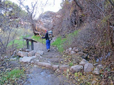
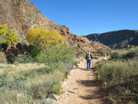
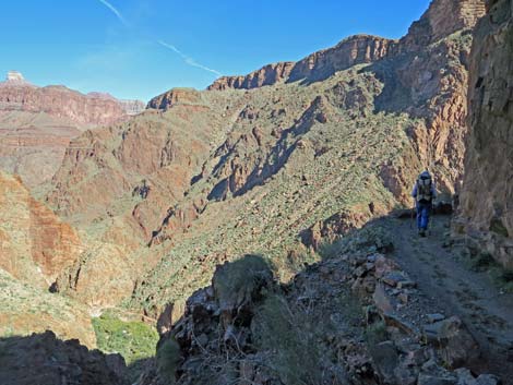
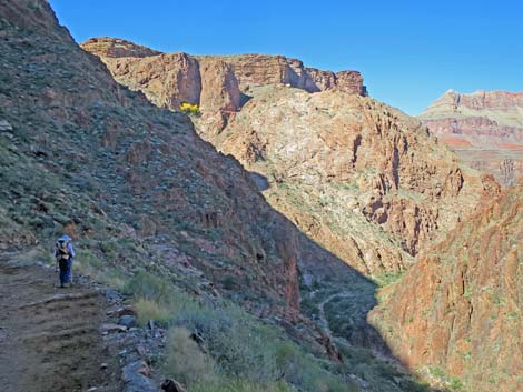
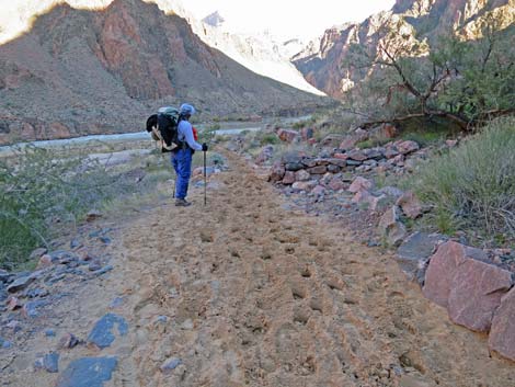
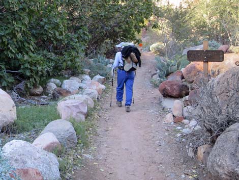
 Hiker continuing down Bright Angel Trail (view NE) |
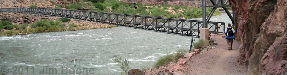
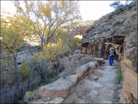
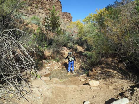
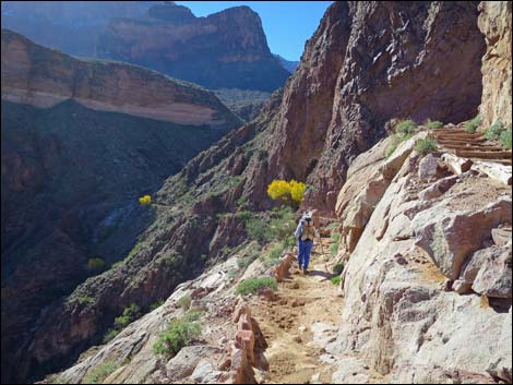
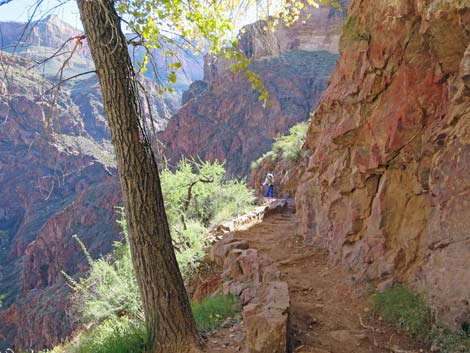
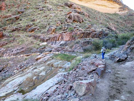
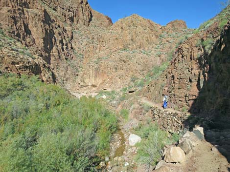
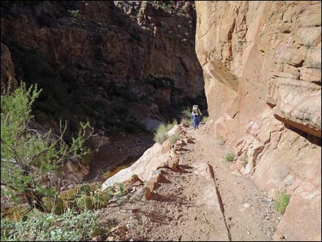
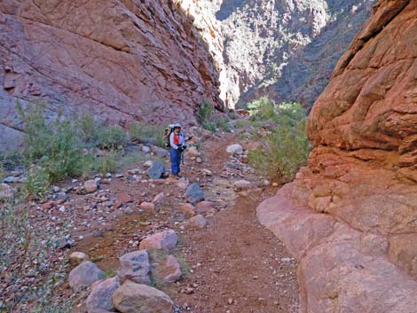
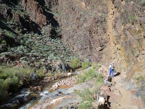
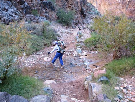
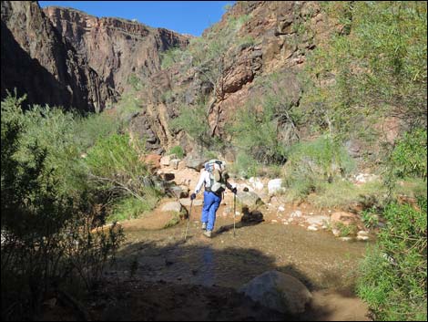
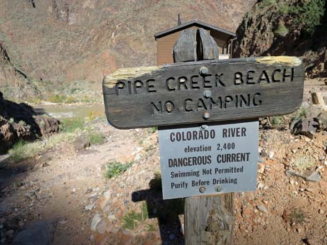
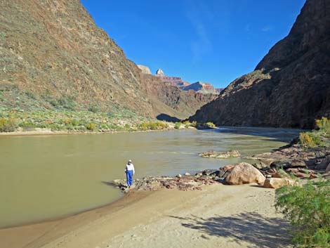
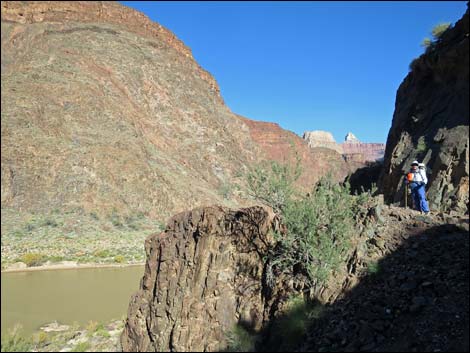
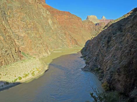
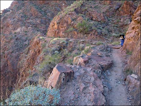
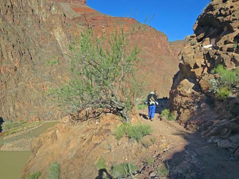
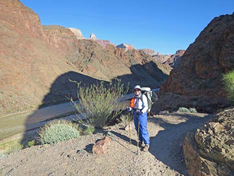
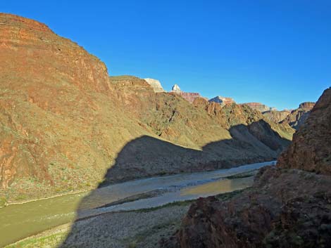
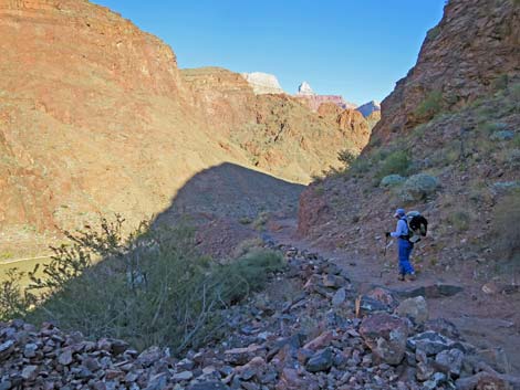
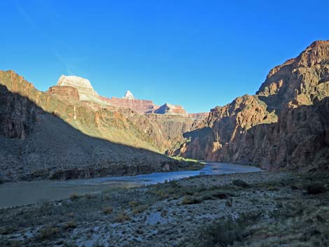
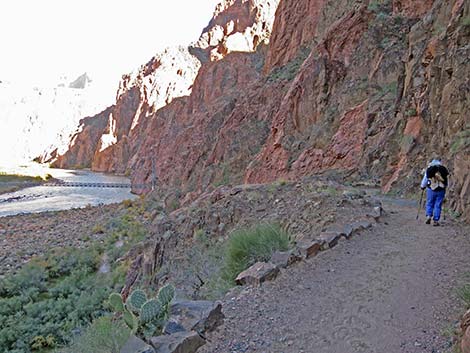
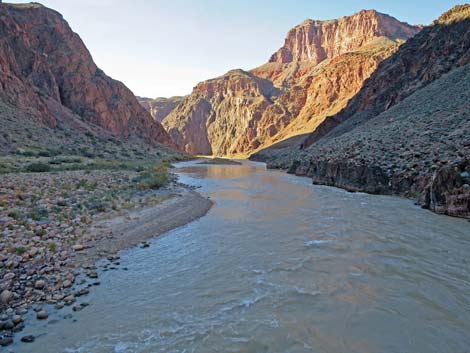
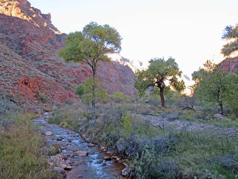
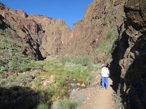
The trail generally runs down the winding bottom of Pipe Canyon or on ledges above the wash, but it also crosses the creek a couple of times. After winding around a couple of tight corners, the trail passes a short spur trail (Wpt. 14) to the River Resthouse on the left across the creek. This is a picnic shelter, and composting toilets are just a bit farther down around the next corner. Just as the Colorado River comes into view, the trail forks (Wpt. 15). The BA Trail continues straight (left) while the River Trail (and composting toilets) goes right to head east. Continuing straight, the BA Trail runs another 100 yards to end at Pipe Beach (Wpt. 16) on the edge of the Colorado River. This point is about 3 miles below Havasupai Garden. Back at the trail junction (Wpt. 15), the River Trail turns right, passes the composting toilets, and continues east following along the south side of the river. The River Trail climbs somewhat steeply to run along cliffs about 200 feet above the river. The trail here was blasted out of the cliff, so there are many nice, unobstructed views of the river. |
 BA Trail at Havasupai Garden day-use picnic shelter (view NE) |
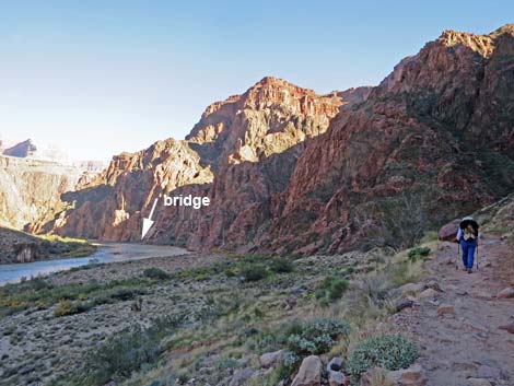
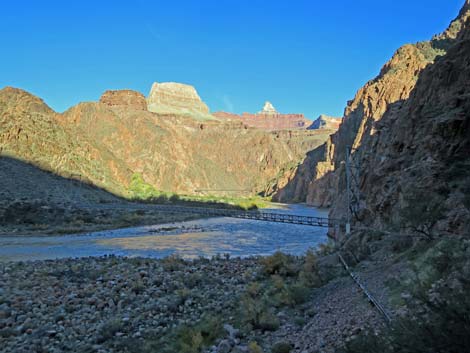
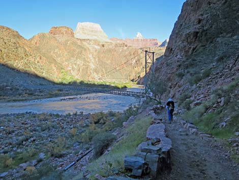
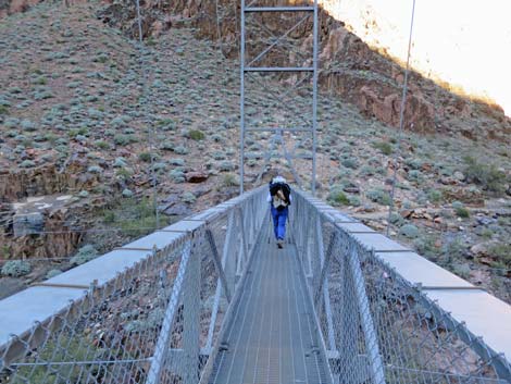
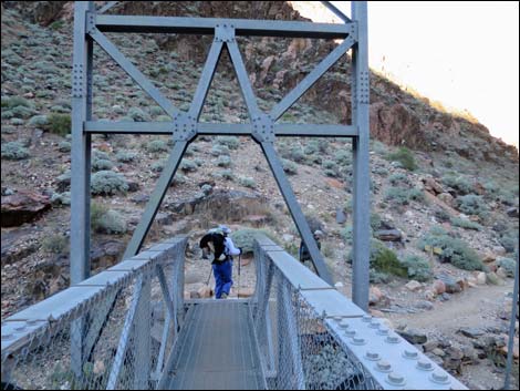
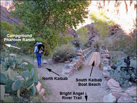
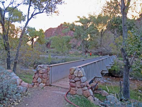
After the first view (Wpt. 17) of the Silver Suspension Bridge in the distance, the cliffs give way to gentler slopes and sandy soils with bunchgrasses, various cactus, and soaptree yucca, and eventually the south end of the Silver Suspension Bridge (Wpt. 18). The River Trail continues upstream along the south side of the river for about 0.5 miles to end at the South Kaibab Trail above the Black Suspension Bridge, but hikers heading for the Phantom Ranch area need to cross the bridge to the north side of the river. Across the river (Wpt. 19), the North Kaibab Tail runs northeast above the beach. The trail quickly passes the stone NPS Mule Barn and Corrals, and then runs through a NPS housing area (note emergency phone outside a house) to a trail junction (Wpt. 20) just before a bridge over Bright Angel Creek (not to be confused with Bright Angel Trail). |
 Bright Angel Trail at Havasupai Garden day-use toilets (view NE) |
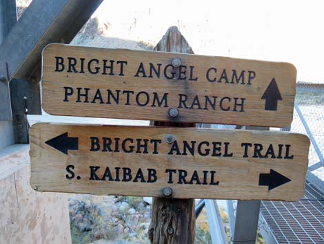
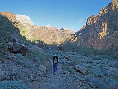
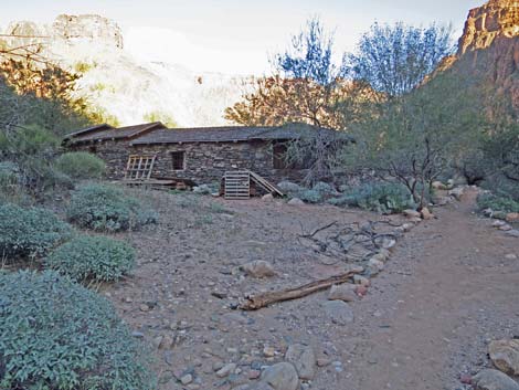
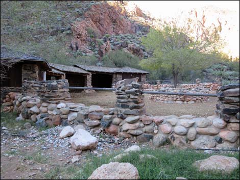
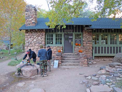
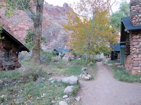
The North Kaibab Trail turns left at the junction (Wpt. 20) and runs up the west side of Bright Angel Creek through Bright Angel Campground (Wpt. 21) and on past the Phantom Ranch Lodge and Cantina (Wpt. 23) to the North Rim. In the Phantom Ranch area, Bright Angel Campground is located about 0.4 miles above the river and is tucked between Bright Angel Creek and the cliffs on the west side of Bright Angel Canyon. The trail runs up the center of this campground, with campsites on both sides of the trail. Water, flush toilets, and electricity are available in the restrooms. Common Ravens, Mule Deer, rodents (mostly Rock Squirrels) and Ring-tailed Cats can a problem here, so be sure to guard your food and store it properly. Store plastic bags properly too because the mule deer eat the bags, develop blockages in their digestive system, and have to be put down. Return to the South Rim by retracing your steps back up the BA Trail, or consider hiking out the steeper, but shorter, South Kaibab Trail. |
 BA Trail at Havasupai Garden day-use rest area (view NE) |
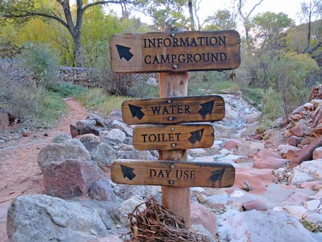
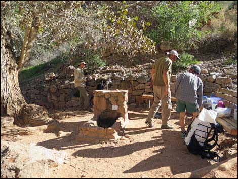
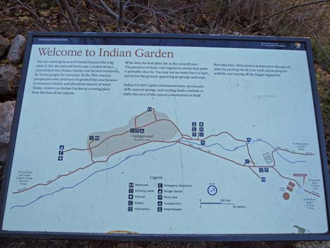
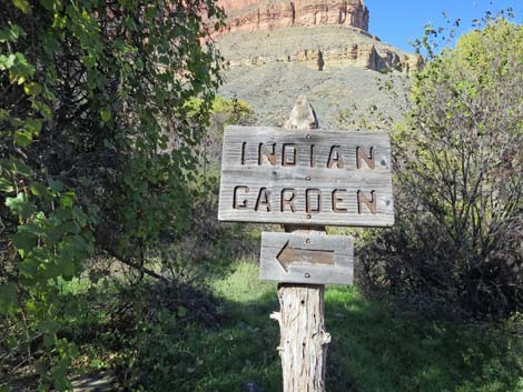
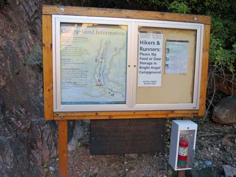
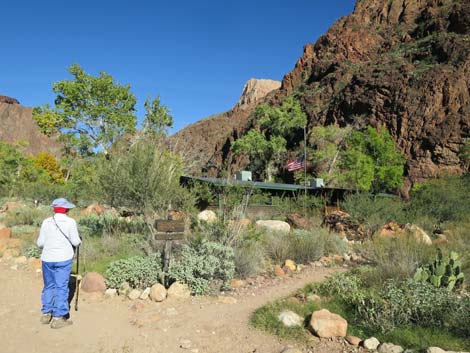
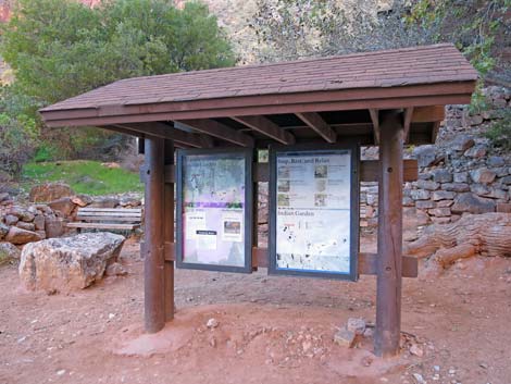 IG area information sign (view E) |
 BA Trail at IG day-use water faucet (view NE) |
 BA Trail departing IG day-use area (view NE) |
 Trail signs at Bright Angel--Plateau Point trail junction (view N) |
 IG Mule barn and hitching posts; trail to Plateau Point (view NW) |
 Trail signs at Bright Angel--Plateau Point trail junction (view N) |
 BA Trail at IG water pumphouse (view NE) |
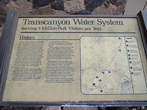 Information sign about the Transcanyon Water System (view E) |
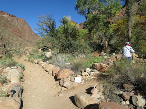
 Hiker passing final Havasupai Garden area sign (view NE) |
 Final Havasupai Garden area sign (view N) |
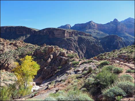
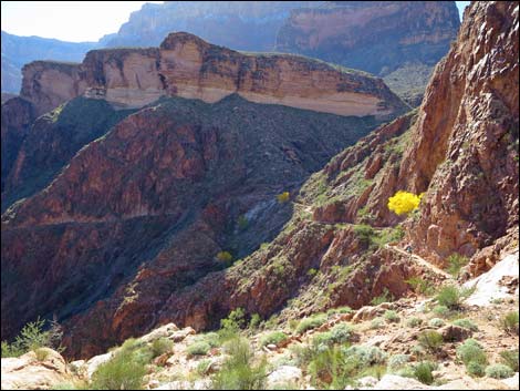
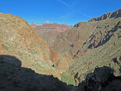
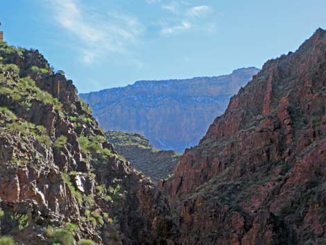
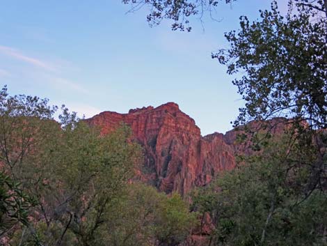
 Grand scenery down Bright Angel Canyon (view NE) |
 Meadow area in Bright Angel Canyon (view NE) |
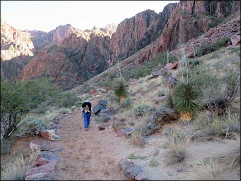
 Finally getting to the warmth of the sun (view NE) |
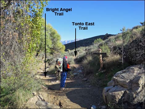 Hiker at junction of Bright Angel Trail and Tonto East Trail (view NE) |
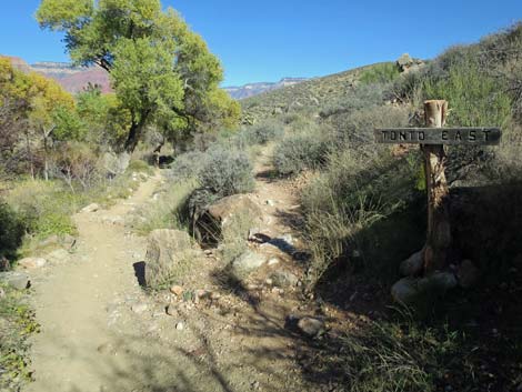 Bright Angel Trail at Tonto East Trail (view NE) |
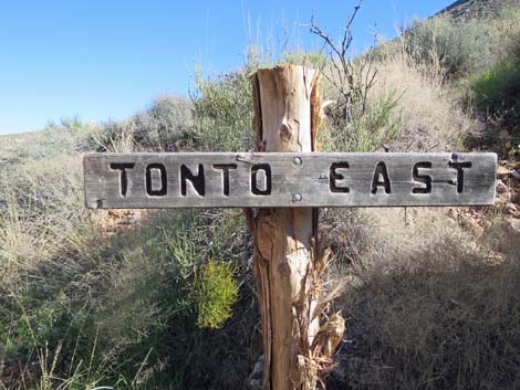 Tonto East Trail sign (view NE) |
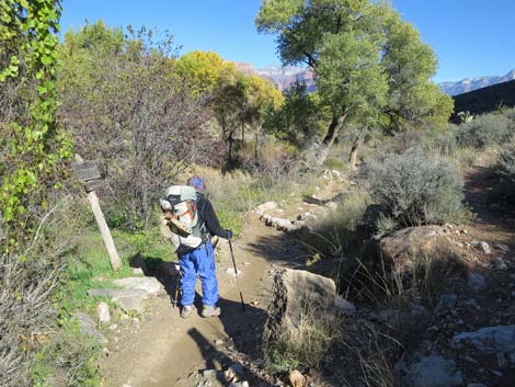 Bright Angel Trail at Tonto East Trail (view N) |
 BA Trail--Tonto East Trail directional sign (view NE) |
 Descending into the Tapeats Sandstone (view NE) |
 Descending into the Tapeats Sandstone (view NE) |
 Descending into the Tapeats Sandstone (view NE) |
 |
 |
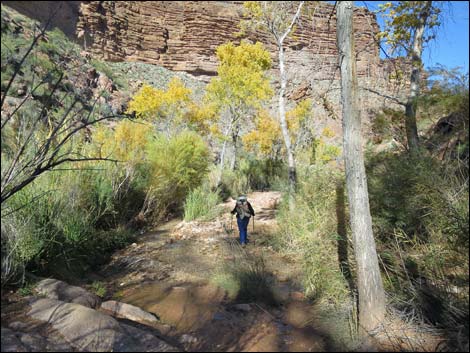
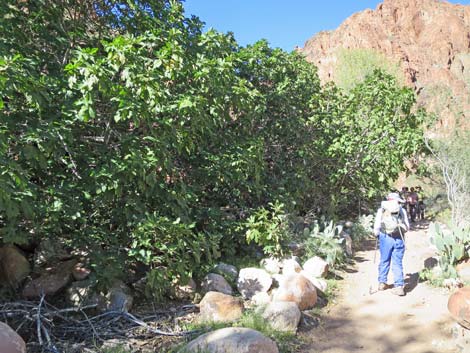
 Open canyon with cottonwood trees (view N) |
 Crossing Havasupai Garden Creek (view N) |
 Great Unconformity at our feet (view SW) |
 Crossing Havasupai Garden Creek again (view N) |
 Open canyon with cottonwood trees (view N) |
 Approaching top of the Devils Corkscrew (view E) |
 IG Creek descends into narrow canyon with falls (view NE) |
 Looking back at IG Creek descending into narrow canyon (view SW) |
 Top of Devils Corkscrew (view SE) |
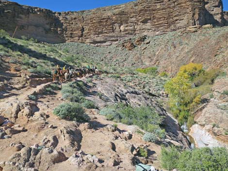 Pack train approaching top of the Devils Corkscrew (view SW) |
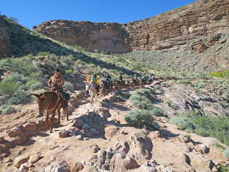 Pack train at top of the Devils Corkscrew (view SW) |
 Hiker descending into Devils Corkscrew (view NE) |
 Hiker descending into Devils Corkscrew (view SE) |
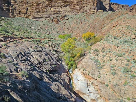
 Hiker at seep along the trail (view S) |
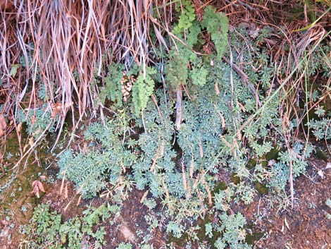 Wetland plants in the desert (view SW) |
 Hiker continuing past the spring (view SE) |
 Hiker crossing Pipe Creek (view SE) |
 Park Service helicopter heading for Havasupai Garden (view NW) |
 |
 |
 Middle of Devils Corkscrew (view SE) |
 Middle of Devils Corkscrew (view NE) |
 Top of Devils Corkscrew switchbacks (view SE) |
 Devils Corkscrew switchbacks (view NW) |
 |
 |
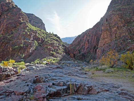
 Bottom of Devils Corkscrew switchbacks; Pipe Canyon (view N) |
 Historic mine adit (it is never safe to enter mines) |
 That's all there is: historic mine adit (mines are never safe) |
 Hiker continuing down Pipe Canyon (view N) |
 |
 |
 |
 |
 |
 |
 Fording Pipe Creek (view N) |
 Fording Pipe Creek again (view N) |
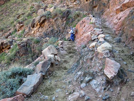
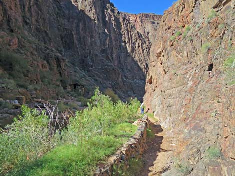 Stone wall along the trail (view NW) |
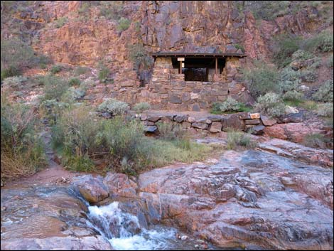 River Resthouse across Pipe Creek (view W) |
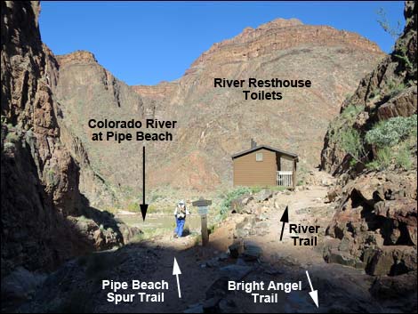 Technical end of BA Trail: Pipe Beach Trail at River Trail (view N) |
 Sign at trail junction (view N) |
 Hiker on Pipe Beach Trail (view N) |
 Hiker at Pipe Beach and the Colorado River (view NE) |
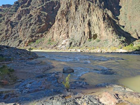 Colorado River downstream and Pipe Canyon Rapids (view NW) |
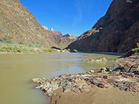 Colorado River upstream (view NE) |
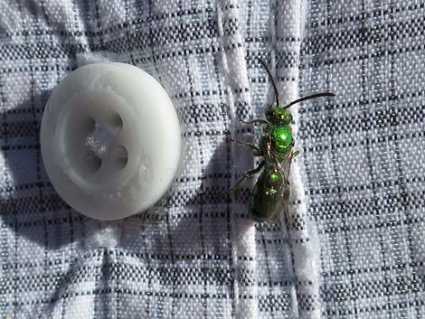 Sharing the beach with friendly little green wasp |
 Pipe Beach, starting back up Pipe Beach Trail (view S) |
 South Rim (view S from Pipe Beach) |
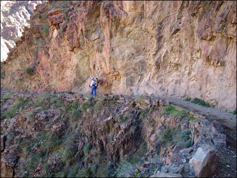
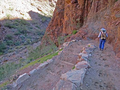
 Hiker on River Trail approaching River Resthouse (view N) |
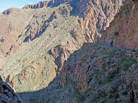
 River Trail climbs above the Colorado River (view NE) |
 High above the Colorado River (view NE) |
 River Trail above the river (view NE) |
 River Trail above the river (view NE) |
 A good spot for a "hero photo" (view NE) |
 Another sunny spot for a "hero photo" (view NE) |
 |
 |
 River Trail descending slowly towards the river (view NE) |
 Sandy trail churned up by mules (view NE) |
 River Trail on sandy flats (view NE) |
 Silver Bridge over the Colorado River comes into view (view NE) |
 |
 |
 |
 |
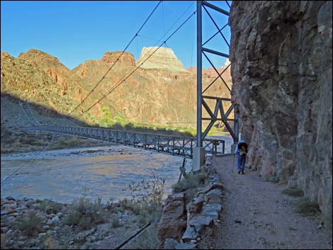 Hiker approaching Silver Suspension Bridge (view NE) |
 River Trail at Silver Suspension Bridge (view NE) |
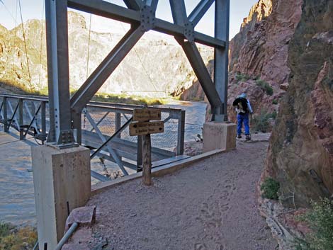
 Trail signs at Silver Bridge (view N) |
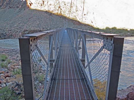 Silver Bridge (view N) |
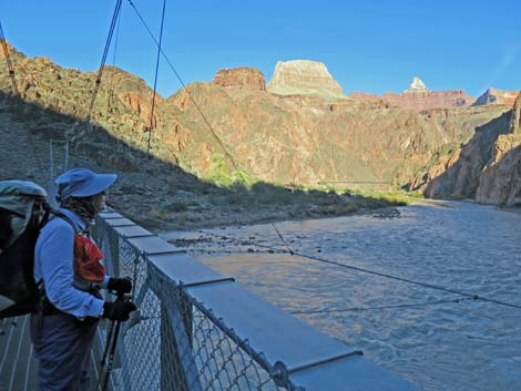 Hiker on Silver Bridge (view NE) |
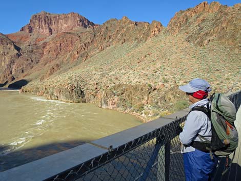
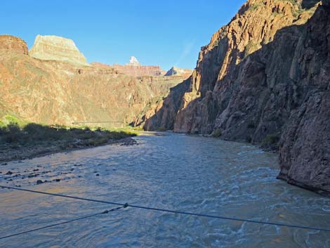 Colorado River (view E from Silver Bridge) |
 Hiker on south edge of Silver Bridge (view NW) |
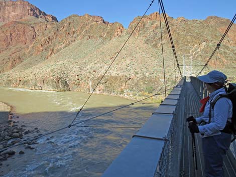
 Hiker on middle of Silver Bridge (view NW) |
 Colorado River (view W from middle of Silver Bridge) |
 Hiker on middle of Silver Bridge (view N) |
 Hiker exiting Silver Bridge (view N) |
 Hiker on north side of the Colorado River (view E) |
 Approaching Phantom Ranch area (view E) |
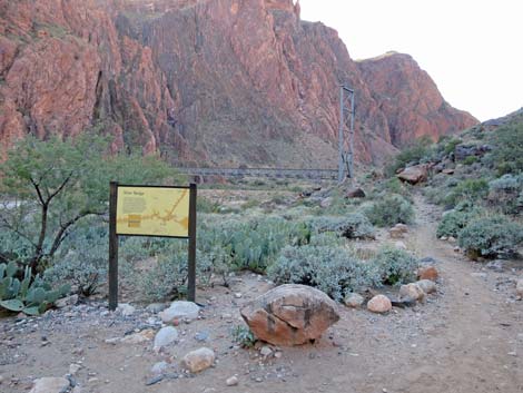 Looking back, information sign about Silver Bridge (view SW) |
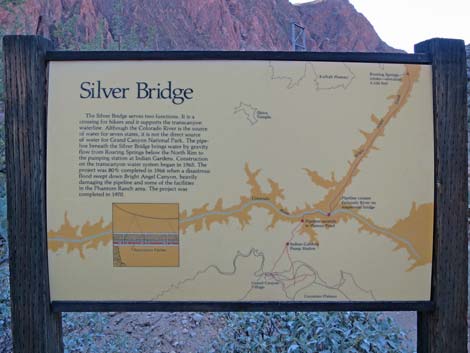 Information sign about Silver Bridge (view SW) |
 NPS Mule Corrals along the trail (view N) |
 |
 |
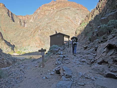
 Hiker entering the Phantom Ranch area (view NE) |
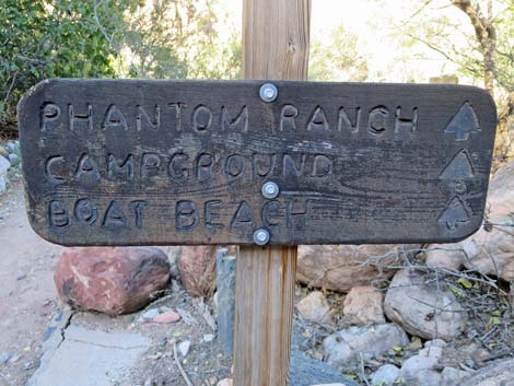 Phantom Ranch area directional sign (view NE) |
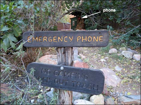 Emergency Phone outside ranger residence (view NW) |
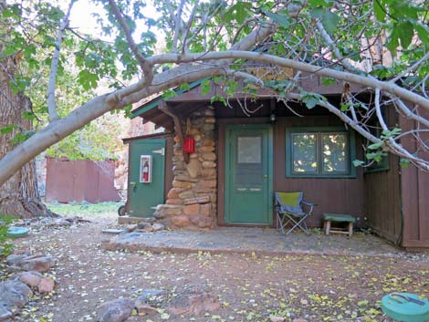 Ranger residence (view NW) |
 Trail junction (left to Bright Angel Campground; view NE) |
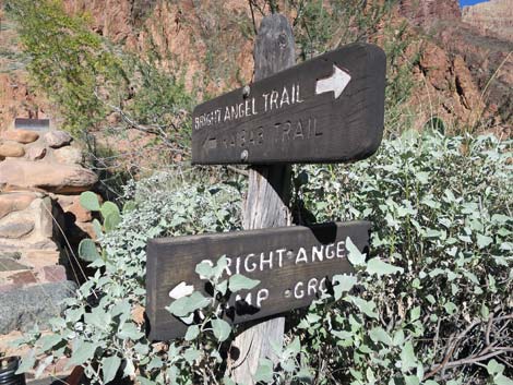 Sign at trail junction (view NE) |
 North Kaibab Trail (view NW towards Bright Angel Campground) |
 Don't stop on this short bit of trail (view NW) |
 Bright Angel Campground information sign (view NW) |
 Campsite in Bright Angel Campground (view NW) |
 Bright Angel Campground Restrooms and drinking water (view N) |
 Campsites in Bright Angel Campground (view N) |
 Campsites in Bright Angel Campground (view N) |
 Bridge at upper end of Bright Angel Campground (view N) |
 Bridge at upper end of Bright Angel Campground (view NE) |
 Bright Angel Creek (view N from bridge) |
 Looking back, Bright Angel Creek (view S from bridge) |
 Following Bright Angel Creek towards Phantom Ranch (view N) |
 Trail junction to PR Ranger Station (view NE) |
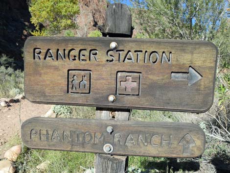 Sign at trail junction to PR Ranger Station (view NE) |
 Trail junction to PR lodge (view NE) |
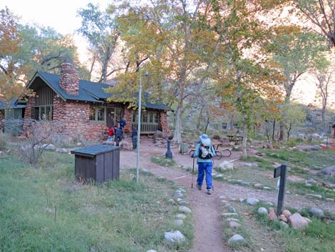 Hiker arriving at Phantom Ranch dining hall/cantina (view NE) |
 Phantom Ranch dining hall/cantina and water faucet (view NE) |
 North Kaibab Trail continues past dining hall (view N) |
 North Kaibab Trail continues up the canyon (view NE) |
 North Kaibab Trail continues up the canyon (view NE) |
 Departing PR heading back to campground |
 Campsite in Bright Angel Campground (view S) |
 Campsite in Bright Angel Campground (view S) |
 Canyon Wren visiting the campsite |
 Campsite in Bright Angel Campground (view S) |
 Sunset colors on the South Rim (view S) |
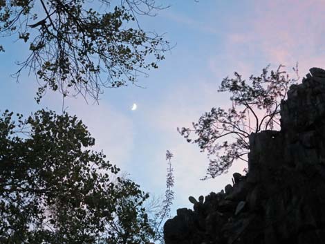 Light sunset colors and moon in the evening sky (view S) |
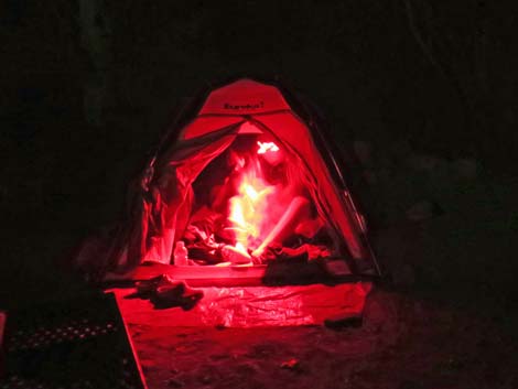 In the tent getting ready for bed (view S) |
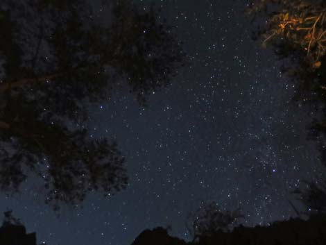 Dark sky (view S) |
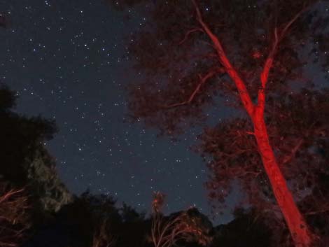 Dark sky with a bit of red-painted tree (view S) |
Table 1. Hiking Coordinates (NAD27, UTM Zone 12S). NOTE: This is UTM Zone 12. Download Hiking GPS Waypoints (*.gpx) file.
| Wpt | Location | Easting | Northing | Elevation | Point to Point Distance | Cumulative Distance |
|---|---|---|---|---|---|---|
| 01 | Trailhead | 397064 | 3990710 | 6,864 | 0.00 | 0.0 |
| 02 | 1.5-Mile Resthouse | 397471 | 3991048 | 5,761 | 1.7 | 1.7 |
| 03 | 2-Mile Switchback | 397204 | 3991307 | 5,469 | 0.4 | 2.1 |
| 04 | 3-Mile Resthouse | 397736 | 3991600 | 4,718 | 1.0 | 3.1 |
| 05 | Havasupai Garden Camp Trail | 398405 | 3992796 | 3,851 | 1.5 | 4.6 |
| 06 | Plateau Point Trail | 398578 | 3993030 | 3,760 | 0.2 | 4.8 |
| 07 | Tonto East Trail | 398836 | 3993435 | 3,700 | 0.3 | 5.1 |
| 08 | Top of Devil's Corkscrew | 399736 | 3994275 | 3,500 | 0.9 | 6.0 |
| 09 | Pipe Wash | 399982 | 3994074 | 2,600 | 0.7 | 6.7 |
| 10 | River Resthouse | 400026 | 3995198 | 2,480 | 0.9 | 7.6 |
| 11 | Pipe Creek Beach Trail | 400067 | 3995294 | 2,440 | 0.1 | 7.7 |
| 12 | View of Silver Bridge | 400709 | 3995363 | 2,520 | 0.5 | 8.2 |
| 13 | South end of Silver Bridge | 401420 | 3995045 | 2,450 | 0.6 | 8.8 |
| 14 | North end of Silver Bridge | 401460 | 3995210 | 2,450 | 0.1 | 8.9 |
| 15 | Campsite 10 | 401425 | 3995536 | 2,480 | 0.3 | 9.2 |
| 16 | Phantom Ranch | 401550 | 3996071 | 2,500 | 0.3 | 9.5 |
Happy Hiking! All distances, elevations, and other facts are approximate.
![]() ; Last updated 240326
; Last updated 240326
| Hiking the Grand Canyon | Hiking Around Las Vegas | Glossary | Copyright, Conditions, Disclaimer | Home |