Hiking Around Las Vegas, Lake Mead NRA, Pinto Valley Wilderness Area

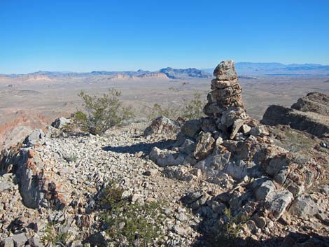 Summit cairn (view NE) |
Overview This moderate off-trail route runs for about 1.3 miles from the Northshore Summit parking area to the top of Northshore Peak. The route follows the east ridge, which is fairly easy except for a few, short 3rd-class sections. Despite the relatively low elevation of the summit, the lay of the land is such that the views from the peak are spectacular. This is a great hike. Presented here are photos of summit views. For a complete description of the hike, including maps and GPS coordinates, see Northshore Peak, East Ridge (or possibly Northshore Peak, West Ridge) |
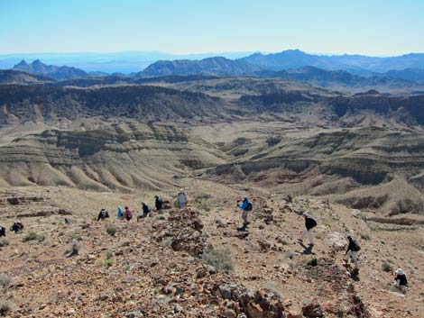
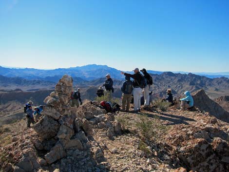 Hikers on summit (view S) |
 Northshore Peak summit (view NW) |
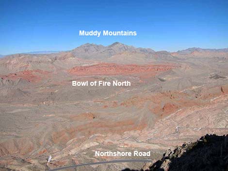
 Summit (view E) |
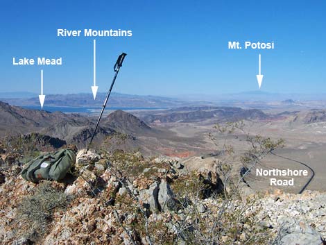
 Summit (view N) |
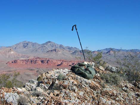
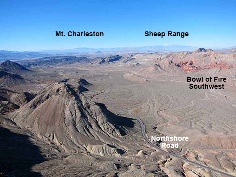
 Summit (view W) |
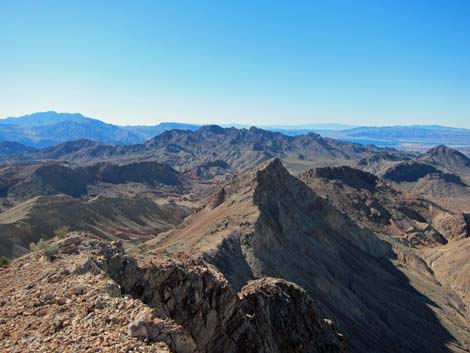
 Summit (view NW) |
 Northshore West Ridge Route (view SW) |
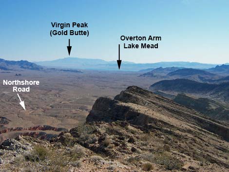
 On the descent, hikers have grand view to the southeast) |
Table 1. Hiking Coordinates Based on GPS Data (NAD27; UTM Zone 11S). Download Hiking GPS Waypoints (*.gpx) file.
| Wpt. | Location | UTM Easting | UTM Northing | Elevation (ft) | Point-to-Point Distance (mi) | Cumulative Distance (mi) | Verified |
|---|---|---|---|---|---|---|---|
| 01 | Trailhead Parking | 713897 | 4011567 | 2,391 | 0.00 | 0.00 | GPS |
| 02 | Edge of Road | 713956 | 4011527 | 2,368 | 0.04 | 0.04 | GPS |
| 03 | Ridge | 714146 | 4010908 | 2,575 | 0.45 | 0.49 | GPS |
| 04 | Top of 1st Scramble Down | 713455 | 4010434 | 3,256 | 0.62 | 1.11 | GPS |
| 05 | Top of 2nd Scramble Down | 713372 | 4010365 | 3,216 | 0.08 | 1.19 | GPS |
| 06 | Northshore Peak Summit | 713264 | 4010322 | 3,303 | 0.10 | 1.29 | GPS |
| 01 | Trailhead Parking | 713897 | 4011567 | 2,391 | 1.29 | 2.58 | GPS |
Happy Hiking! All distances, elevations, and other facts are approximate.
![]() ; Last updated 220605
; Last updated 220605
| Hiking Around Lake Mead | Hiking Around Las Vegas | Glossary | Copyright, Conditions, Disclaimer | Home |